
James Fort, Kinsale: A Visitor Guide to the Unguided Castlepark Fort

James Fort is an unguided fort south of Kinsale on the Castlepark peninsula, where it was built to defend the town's inner harbour. Heritage Ireland, which publishes the site for the Office of Public Works, treats it as a place you explore on your own rather than a managed attraction with staff on hand.
The official page carries a notice that the site is unguided and that visitors should maintain care and caution throughout, with the Office of Public Works stating it will not be held responsible for damages, injuries or losses. That framing matters more than any single feature: there are no published visitor facilities here, so the sensible approach is to treat the fort as historic ground you assess for yourself.
What follows covers what survives, why the fort was placed where it is, how it fared through the seventeenth century, and how it differs from the staffed fort across the water. Opening arrangements, facilities and current site conditions are things to confirm with Heritage Ireland before you travel, since nothing of that kind is set out for James Fort.
Where James Fort Sits
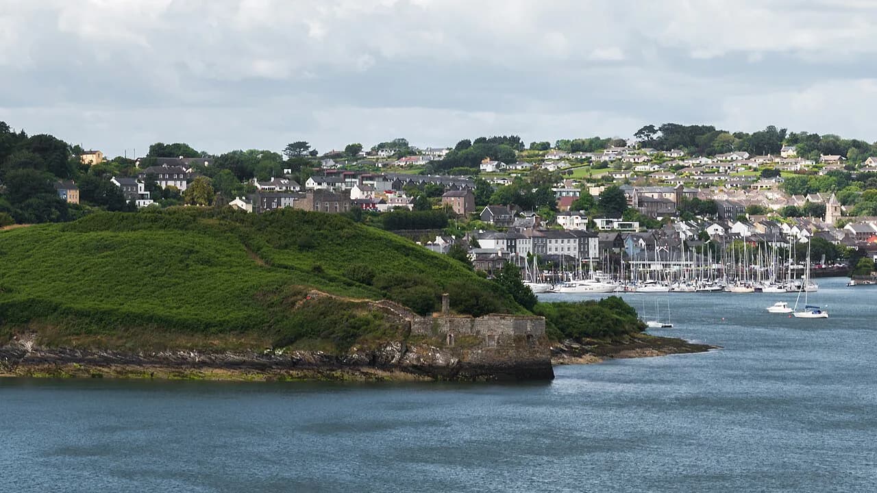
The fort occupies the Castlepark peninsula, the land south of Kinsale that reaches toward the harbour mouth. Across the water stands Charles Fort, and the pairing is the key to reading the landscape: two fortifications facing each other over the channel they were meant to control.
Heritage Ireland explains that James Fort and its blockhouse were built to defend Kinsale's inner harbour, principally against attack coming up the Bandon River. Understanding that orientation helps a visitor make sense of the site, because the fort's purpose was tied to the water it overlooked rather than to the town behind it.
For orientation around the wider town, the Kinsale Attractions overview gathers the main sites into a small compass, which is useful when deciding how to divide a day between the peninsula and the streets. James Fort is the outlier: unlike the staffed sites, it publishes no hours, facilities or admission details of its own.

What "Unguided" Means Here
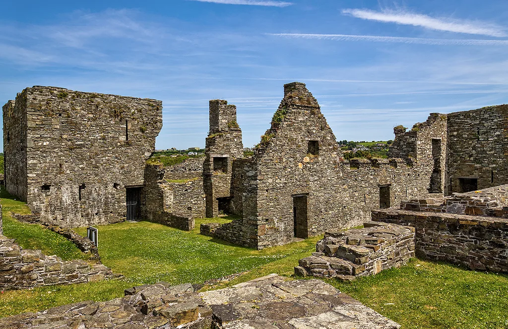
An unguided site is exactly that: no interpreter, no tour schedule, no staffed reception point, and no published list of facilities or maintained paths. The Office of Public Works notice asks visitors to exercise care and caution at all stages, which places the assessment of ground, footing and route squarely on the visitor.
The fort is a national monument protected under the National Monuments Acts 1930 to 2014, so the expectation is that visitors leave masonry, earthworks and the blockhouse as they find them. The official notice does not describe fences, lighting or signage, so plan to read the ground for yourself rather than relying on waymarking.

What Survives on the Ground
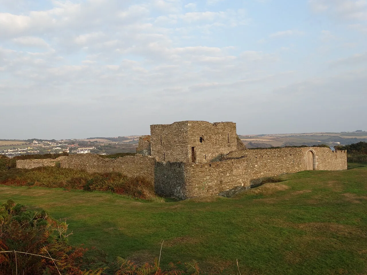
The surviving fort is a bastioned structure, and the commentary published by The Irish Aesthete describes a four-sided fortress set within a pentagonal bastion, with various internal structures that once accommodated troops. That description is worth carrying with you, because ruins of this kind reveal their plan slowly and reward a slow circuit rather than a quick look.
Near the water's edge lie the remains of a hexagonal blockhouse, approached in the original scheme from James Fort by a covered way. Heritage Ireland records that it is thought to have been built around 1604 at a reported cost of fifty pounds, with firing capabilities for at least eight guns, a magazine and quarters for soldiers, and that in more recent times local fishermen used it for storing equipment.
Treat the blockhouse as fragile historic fabric rather than a viewpoint or a place to step inside; its value is in seeing how a shore-level gun position related to the larger fort above. Published material makes no case for entering it, and common sense about old masonry should settle the question.
From Earlier Tower to Pentagonal Fort
James Fort was not the first fortification on this ground. Heritage Ireland notes that the seventeenth-century bastioned fort replaced an earlier tower, and that the position was much strengthened by the Spanish in 1601; work on a pentagonal fort under the engineer Paul Ives began in February 1602 and was completed by 1604, named for James I of England.
The Irish Aesthete adds reported detail that the official page does not: that the earlier structure was known as Castle Ny-Parke and was occupied for a time by Spanish troops during the Siege of Kinsale before they were displaced by Sir Richard Smyth. The same account attributes the design to Paul Ive, author of a 1589 treatise on fortification, and puts the cost of the work at six hundred and seventy-five pounds.
Read those figures as reported history rather than official record. The two accounts differ in emphasis: Heritage Ireland credits Paul Ives with the pentagonal fort and dates the work from February 1602, while The Irish Aesthete discusses Castle Ny-Parke and a separate cost figure, so treat the names and sums as reported detail rather than settled fact. Both agree, however, on a new fort raised quickly on Ireland's southern coast at a vulnerable moment.
Why the Harbour Channel Limited the Guns
Position alone did not make James Fort a deterrent. Heritage Ireland explains that the sea channel was too shallow on the Castlepark side for the fort's guns, given their range of fire, to be effective against a seaward attack, so the fort's real work was defending the inner harbour from approach up the Bandon River.
That detail is the most useful thing a visitor can know before walking the site, because it turns a scenic ruin into a lesson in military geography. Guns cover water they can reach; here the water nearest the fort was the least useful to it, which is why the sister fort took the opposite shore.
Repairs, Capture and the Gunpowder Explosion
The fort's seventeenth-century record is a sequence of damage and repair. Heritage Ireland records repairs in 1611, capture by Cromwellian supporters in 1649, and further repairs in 1677, followed in 1690 by the Williamite capture of James Fort after an explosion within its gunpowder stores during the Williamite campaign around Kinsale.
The Irish Aesthete places earlier action at the fort in the 1640s during the Confederate Wars and describes steady decline afterwards, with the site already described as a ruin by the nineteenth century. Taken together, the two accounts explain why the visitor sees earthworks and fragments rather than standing buildings: this is a fort that was repeatedly damaged and left in ruin.
Overtaken by Design: Charles Fort Across the Water
James Fort was outpaced by changes in fortification design: the Irish Aesthete notes that increasingly sophisticated star-shaped bastions on the French model made Paul Ive's earlier work look dated, and the response was a larger, more modern fort on the other side of the harbour entrance. Heritage Ireland credits William Robinson, architect of the Royal Hospital Kilmainham, with designing Charles Fort, a late seventeenth-century star-shaped structure whose outer defences rise to some sixteen metres.
Charles Fort withstood a thirteen-day siege during the Williamite Wars and was burned out by anti-Treaty forces during the Civil War of the early 1920s, according to its official page. Its ramparts give wide views over Kinsale Harbour, which is precisely the perspective from which James Fort's siting makes sense.
Pairing the Two Forts on One Outing
The two forts are different kinds of place, and it is worth being clear about that before setting out. Charles Fort is a staffed, ticketed site with its own published seasonal hours and last-admission times, and its café keeps separate daily hours; none of that applies to James Fort, which publishes no hours, prices or facilities at all.
A sensible pattern is to take Charles Fort with its interpretative support and fixed timetable, then treat James Fort as an unguided counterpoint where the visitor supplies the reading. Allow time on your own judgement for rough historic ground, and do not transfer Charles Fort's opening arrangements, admission or café to the other site.
Practical Framing for a Visit
Because Heritage Ireland publishes no visitor facilities, opening times or admission details for James Fort, check the official page for current information before travelling and plan on the basis of what it states. The one constant is the caution notice: the site is unguided and a level of care is expected throughout the visit.
Time needed and route choices are matters of personal judgement rather than published guidance, so a shorter look from ground you can assess is a perfectly reasonable visit. Anyone unsteady on their feet, or visiting with young children, should weigh the unguided nature of the site carefully; there is no staffed assistance on hand.
Back in town, the Kinsale museum and St Multose Church make a natural contrast to a windswept peninsula and are worth looking up alongside a visit to the fort.
Making Sense of James Fort
James Fort rewards visitors who arrive knowing what it is: an unguided, State-protected ruin on the Castlepark peninsula, built to guard Kinsale's inner harbour and hobbled from the start by water too shallow for its guns. Its value lies in the earthworks, the harbour relationship and the story of repeated damage and repair, not in facilities or presentation.
Walk it with the official caution notice in mind, leave the blockhouse and masonry untouched, and confirm current details with Heritage Ireland before you go. Paired with the staffed fort across the harbour, it explains more about how this coast was defended than either site does alone.
Frequently Asked Questions
Is James Fort in Kinsale open to visitors?
Heritage Ireland lists James Fort as an unguided site that visitors may walk, but publishes no opening hours, admission details or facilities. The official page asks visitors to maintain care and caution throughout, with the Office of Public Works disclaiming responsibility for damages, injuries or losses. Check the Heritage Ireland page for current information before travelling.
What is there to see at James Fort today?
The site preserves a bastioned fort, traces of internal structures that once housed troops, and the remains of a hexagonal shore-level blockhouse linked in the original scheme by a covered way. It is a ruin without presentation, so the interest lies in reading the plan and the relationship to the harbour rather than in any display.
Why could James Fort's guns not defend against a seaward attack?
Heritage Ireland explains that the sea channel on the Castlepark side was too shallow for the fort's guns, given their range, to be effective against ships attacking from the sea. The fort was therefore built chiefly to defend the inner harbour from approaches up the Bandon River, which is why its partner fort took the opposite shore.
Should I visit James Fort or Charles Fort?
They serve different purposes. Charles Fort is staffed and ticketed, with published seasonal hours, last-admission times and its own café, while James Fort is unguided with no facilities or hours published. Many visitors take Charles Fort for interpretation and harbour views, then treat James Fort as a quiet counterpoint where they supply the reading themselves.
Is James Fort suitable for families or anyone unsteady on their feet?
Heritage Ireland gives no accessibility information for James Fort and simply states that the site is unguided with a level of care and caution required. There are no staff on hand and no published facilities. Families and visitors with limited mobility should judge the ground for themselves and keep to areas they can assess.