Limerick History: From Viking Town to Georgian City
Limerick history runs from a Viking settlement around 922 AD through medieval sieges to the Georgian grid of Newtown Pery. See where each layer sits.
On this page
Limerick is a layered city rather than a single-period one. The local authority describes a place almost 1,100 years old that has been a Viking settlement, a medieval walled town and a Georgian city in turn, and the physical traces of each phase sit close enough to read on foot.
This guide follows that sequence: the Viking foundation, the medieval core around St Mary's Cathedral and King John's Castle, the four sieges, and the Georgian grid of Newtown Pery built once the walls came down. It closes with the prehistoric and medieval monuments of County Limerick, which belong to the same story but sit well outside the city streets; our Limerick walking tour covers the city-core route on foot.
Viking Origins on the Shannon
The official city history dates Limerick's foundation by the Vikings to around 922 AD, and a Roots Ireland county survey gives the same year for a settlement established on an island on the River Shannon. Roots Ireland's account is itself drawn from Mainchín Seoighe's Portrait of Limerick, so treat the date as a traditional founding figure rather than a documentary certainty.
What matters for a visitor is the commercial character of that first town. The city history notes that the Vikings were traders and craftsmen whose Limerick had contacts with Viking towns elsewhere in Europe, which explains why the settlement grew at a navigable point on the Shannon rather than inland.
The river remains the clearest orientation aid in the city: the medieval core and the later Georgian streets both relate back to it. A riverside walk is the simplest way to grasp why the original settlement sat where it did.
The Medieval City: Cathedral, Castle and Walls
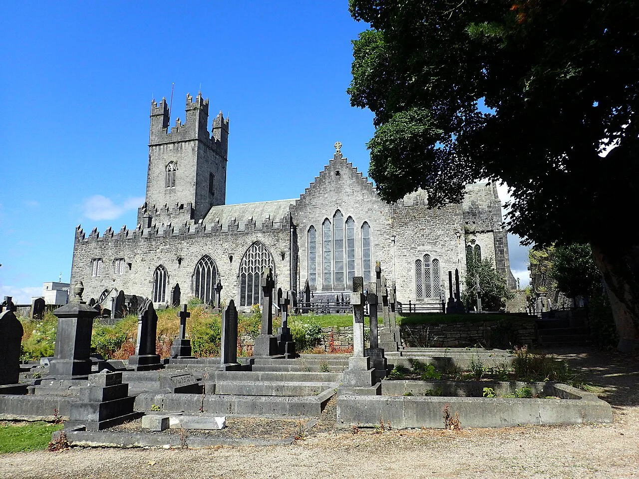
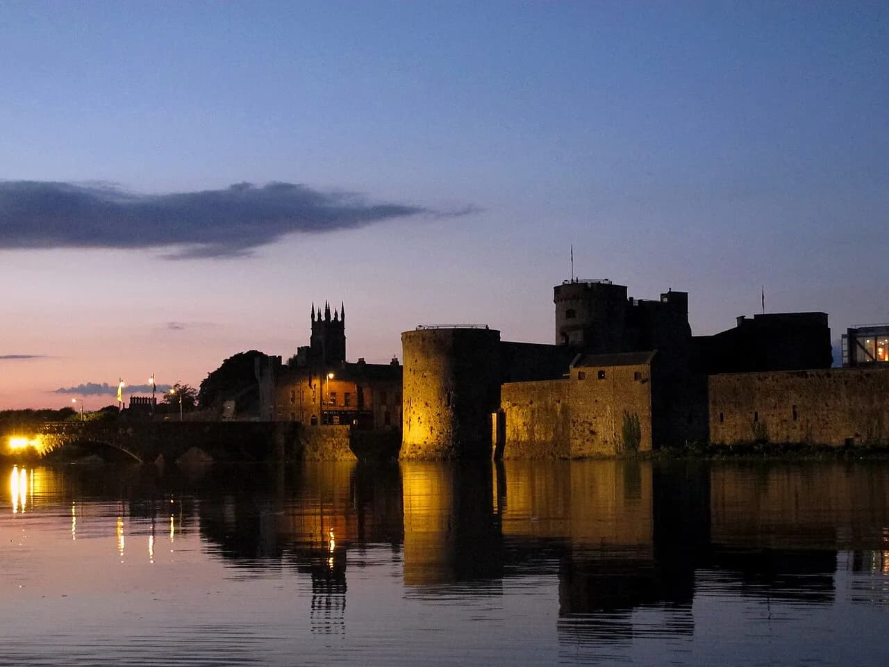
St Mary's Cathedral was founded in the twelfth century and is described as the oldest building in Limerick still in use for its original purpose. The Normans captured the city in 1195, and their interventions left a lasting mark: King John's Castle, the town walls and a local government system all survived into the present.
Separate what is visible from the street from what requires going inside. The castle and surviving wall fragments are named in the official account as Norman survivals, but this guide makes no claim about current opening arrangements, admission or whether interiors and towers can be entered; check with the individual site before relying on access.
If the castle prompts an interest in military architecture, the wider county offers far more of it. The county history records that over four hundred castles were built in Limerick, more than in any other Irish county, which makes the city castle a starting point rather than a summary.
The cathedral and the castle also anchor the medieval street pattern, which is denser and more irregular than the Georgian grid to the south. Walking between the two gives the clearest physical sense of how the city was reorganised over centuries rather than rebuilt all at once.
A Walled City-State: The 1413 Charter and the War with Galway
In 1413 Henry V granted a charter making Limerick an independent city-state, and the official history notes that the city even conducted its own foreign policy. That unusual autonomy is the context for one of the stranger episodes in the city's past: in 1524 Limerick and Galway went to war, apparently ending as a draw and concluded by a formal peace treaty.
The Tudor period curtailed this independence. The official account describes Henry VIII's break with Rome, the dissolution of the monasteries and the granting of their lands to loyal supporters, with the English crown controlling all of Ireland by 1603 and Limerick losing most of its medieval autonomy.
This is worth holding in mind when reading later street names and civic buildings: the city's institutions were shaped by a long contest over who governed it. The traces are less monumental than a castle, but they explain why Limerick's civic history reads differently from that of a town that simply passed between landlords.
The Century of Sieges and the Treaty of Limerick
The seventeenth century was the most violent in both Irish and Limerick history. The city endured four sieges, in 1642, 1651, 1690 and 1691, and the official history frames it as a central stage in European wars rather than a local dispute.
After the fourth siege the Treaty of Limerick was signed, and Patrick Sarsfield and other Catholic leaders left the city and Ireland, beginning the Flight of the Wild Geese. The genealogy survey adds that the treaty's terms were subsequently dishonoured, a detail that turns the event from a conclusion into the start of a longer grievance.
The sieges also explain why comparatively little medieval fabric survives above ground in the city centre. Where a town is besieged four times in fifty years, the streets you walk today are the successor to the medieval city as much as a survival of it.
Newtown Pery: Taking Down the Walls
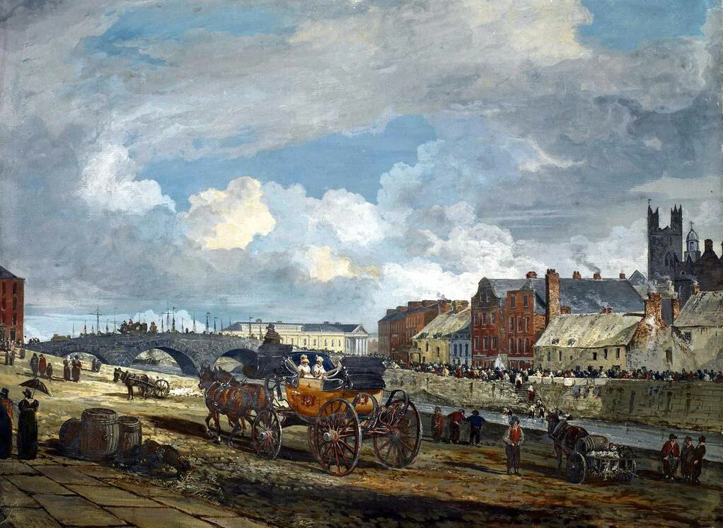
From the 1760s Limerick's walls were taken down to let the city expand. The local landlord and MP Edmund Sexton Pery decided to build a new city on his land south of the medieval town, and in 1769 Christopher Colles produced a grid plan for it; the result was named Newtown Pery after its founder.
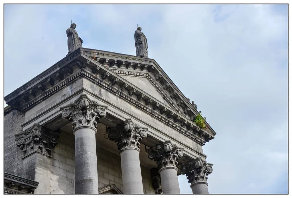
This is the single most useful fact for understanding Limerick's shape. The Georgian streets are not a later overlay on a medieval plan but a deliberate replacement built on open ground, which is why the transition from the old core to the grid feels abrupt rather than gradual.
Georgian Limerick also belongs to a broader Irish urban story, and comparing it with other cities makes the planning logic clearer. Readers following the same theme elsewhere can set it alongside Dublin history and Cork history, both of which trace comparable phases of expansion.
Nineteenth-Century Change and Social History
The nineteenth century brought civic infrastructure as well as industry. The official history lists the fire service, gas supply, water supply, social housing, sewerage, public health provision and the first public library among the period's introductions, alongside churches, schools and traditional industries such as bacon curing, flour milling, dairy processing, lace and clothing.
A Limerick history research blog, edited by historian Liam Hogan, documents the harder side of that period, drawing on Medical Officer Dr Michael McGrath's public health reports from 1912 to 1914 and covering a dock strike in 1913. That material adds texture to the civic story, but it is a research blog rather than official visitor information, so treat it as historical context rather than a guide to what can be seen today.
For the indoor, collection-based side of the city's history, the museums in Limerick are the natural next step after the streets. Checking individual venues directly remains the reliable way to confirm what is currently on display.
Beyond the City: Lough Gur and the Medieval County Towns
County Limerick holds evidence of settlement going back roughly 5,000 years. Lough Gur is described as one of Ireland's most important archaeological sites, containing the country's largest stone circle, a dolmen and other prehistoric remains; a county survey dates the stone circles to around 3000 BC as an archaeological estimate.
The county's medieval heritage is spread across named towns rather than concentrated in one place. The official history points to castles and abbeys at Adare, Askeaton, Kilmallock and Newcastle West, and describes Adare as notable for its manor and thatched cottages. These are named as monuments, not as ticketed attractions, so confirm access locally before planning around any single one.
Sources differ on when County Limerick took its present administrative shape, with the official history placing it in the 1250s and the genealogy survey citing 1210. Both point to the same Anglo-Norman reorganisation of the area, and the discrepancy is a reminder that county boundaries are administrative decisions rather than historical events with a single date.
Orienting Yourself on Foot
The most efficient way to read Limerick's layers is to start at the medieval core by the river, where the cathedral and castle sit, then walk south into the Georgian grid. The change in street width, building line and regularity does most of the explaining for you.
Keep expectations bounded. Public streets and public monuments can be seen on any walk, but interiors, towers and guided access depend on arrangements published by each site. The historical sources used here describe the buildings and events, not current opening arrangements, so check with an individual venue before setting out if a specific interior matters to you.
The county sites are a separate excursion rather than an extension of a city walk. Lough Gur and the medieval towns of Adare, Askeaton, Kilmallock and Newcastle West sit outside the urban core, so treat them as day trips with their own logistics rather than stops on a city route.
Plan Your Visit
Limerick rewards a visitor who arrives knowing the sequence: Viking trading settlement, medieval walled city, four sieges and a treaty, then a Georgian grid built on purpose once the walls were gone. That order turns a scatter of individual sites into a readable city.
Use the official history as the spine, add the county survey for the wider archaeological and medieval picture, and verify current access for any site where going inside matters. The streets themselves require no booking and carry much of the story.
Explore more Limerick guides
Frequently Asked Questions
Why is Limerick described as almost 1,100 years old?
The official city history puts the Viking foundation at around 922 AD, which produces that figure. A county genealogy survey gives the same year and describes the settlement as founded on an island in the Shannon. Treat the date as a traditional founding point rather than a precisely documented event.
What survives from Limerick's medieval city?
St Mary's Cathedral, founded in the twelfth century and described as the oldest building still in original use, is the key survival. The official history also names King John's Castle and the walls of Limerick among the Norman legacies. Whether interiors are open is a separate question to check with each site.
What happened at the sieges of Limerick?
The city was besieged four times, in 1642, 1651, 1690 and 1691. After the fourth, the Treaty of Limerick was signed and Patrick Sarsfield and other Catholic leaders left Ireland, beginning the Flight of the Wild Geese. A county survey notes that the treaty terms were later dishonoured.
Why does Newtown Pery look so different from the medieval core?
Because it was planned as a new city rather than grown organically. From the 1760s Limerick's walls were removed, Edmund Sexton Pery initiated development on his land south of the old town, and Christopher Colles produced a grid plan in 1769. The regularity of the Georgian streets reflects that deliberate design.
What prehistoric and medieval sites lie outside Limerick city?
Lough Gur is the main prehistoric site, described as containing Ireland's largest stone circle, a dolmen and other remains, with a stone circle dated to around 3000 BC as an archaeological estimate. For the medieval period, the official history names castles and abbeys at Adare, Askeaton, Kilmallock and Newcastle West.
Can I see all of this on foot?
The city layers work well on foot: the medieval core by the river and the Georgian grid to the south are close together, and the change in street pattern is visible as you walk. The county sites, including Lough Gur and the medieval towns, are separate trips rather than part of a city walk.
Sources
You might also like
Continue reading
More guides you'll find useful