
Bohermore, Galway: The Old Approach Road and Its New Cemetery

Bohermore is the old road running east out of Galway from The Green, now Eyre Square, toward Cemetery Cross, and it rewards a slow walk more than a single stop. Its interest is layered: a route that was once the main way in and out of town, a Victorian burial ground, and a set of 1930s terraces with their own social history.
This guide treats Bohermore as a district, not just a cemetery visit. It traces the names the road carried, the 19th-century community recorded along it, why the New Cemetery was sited here, and how the 20th century reshaped the area around it.
Orientation: A Road East from Eyre Square
On the 1651 map of Galway, as described in Tom Kenny's local history essay, Bohermore runs from The Green, the space now occupied by Eyre Square, to the present Cemetery Cross. That framing is useful for a visit: you can follow the district as a line rather than a cluster, starting near the city centre and walking east.
Because the district stretches along a road, plan a one-way walk rather than a loop, and allow time to stop at the cemetery end. The far end at Cemetery Cross is the natural turning point, where the historical approach road meets the burial ground that took its name from the area.
Bohermore suits travellers interested in street history, graveyard heritage and ordinary 20th-century urban development. It does not have the concentrated visitor infrastructure of the centre, so treat it as a half-day add-on rather than the anchor of a trip.
Names and Boundaries: The Great Lane and the Royal Highway
Kenny's essay records that Bohermore was originally called The Great Lane or The Royal Highway, and that it was the main road in and out of town. Those older names explain the district's shape: a corridor of movement rather than a planned square or suburb.
The same account places St Bridget's Hill to the left and right of the road and gives the area around Prospect Hill the name Knocknaganach, meaning the Sandy Hill. These are local historical names rather than current official districts, so read them as clues to how the area was understood, not as addresses to search for on a modern map.
The 1651 map also showed an old gallows at the present Cemetery Cross, close to where the present cemetery stands. Treat this as a historical note about the road's former edge-of-town role, not as a surviving monument you can visit.
Nineteenth-Century Bohermore: Houses, People and a School
Kenny's essay gives 1812 figures for Bohermore: 378 inhabited houses occupied by 432 families, seven houses being built and 17 uninhabited, with a total population of 2,044. Read these as one local historian's figures drawn from older parish writing rather than as official census data, but they still convey a densely settled road well before the 20th century.
In 1852 a boys' school was registered on the road, in a building leased from James Davis, with an enrolment of about 30 boys. It is a reminder that Bohermore was a working residential district with its own institutions, not simply the approach to a cemetery.
Why the New Cemetery Came to Bohermore
By the second half of the 19th century, Galway's older graveyards were overcrowded, and a mid-April 1873 meeting of the Town Commissioners heard that almost two and a half thousand burials had taken place in the previous 30 years in the small Claddagh cemetery, largely because of the Famine and its aftermath. The historical account describes the New Cemetery as an attempt to bring order and dignity to burial in the city.
Among the sites considered was one outside the city on Bohermore, and a letter from Bishop McEvilly arguing against extending Fort Hill was largely responsible for the choice. The land was bought from the board of the Erasmus Smith School. The Advertiser history dates the opening to 1873, while Kenny's essay gives 1880, so treat the exact founding year as unsettled and the 1870s as the reliable frame.
The new burial ground was known, and is still known locally, as the New Cemetery, though it is also called Bohermore Cemetery after its location at Cemetery Cross. Galway City Council lists it alongside Mount St. Joseph Cemetery at Rahoon as one of the two cemeteries it operates.

Reading the Cemetery Today: Chapels, Memorials and Names
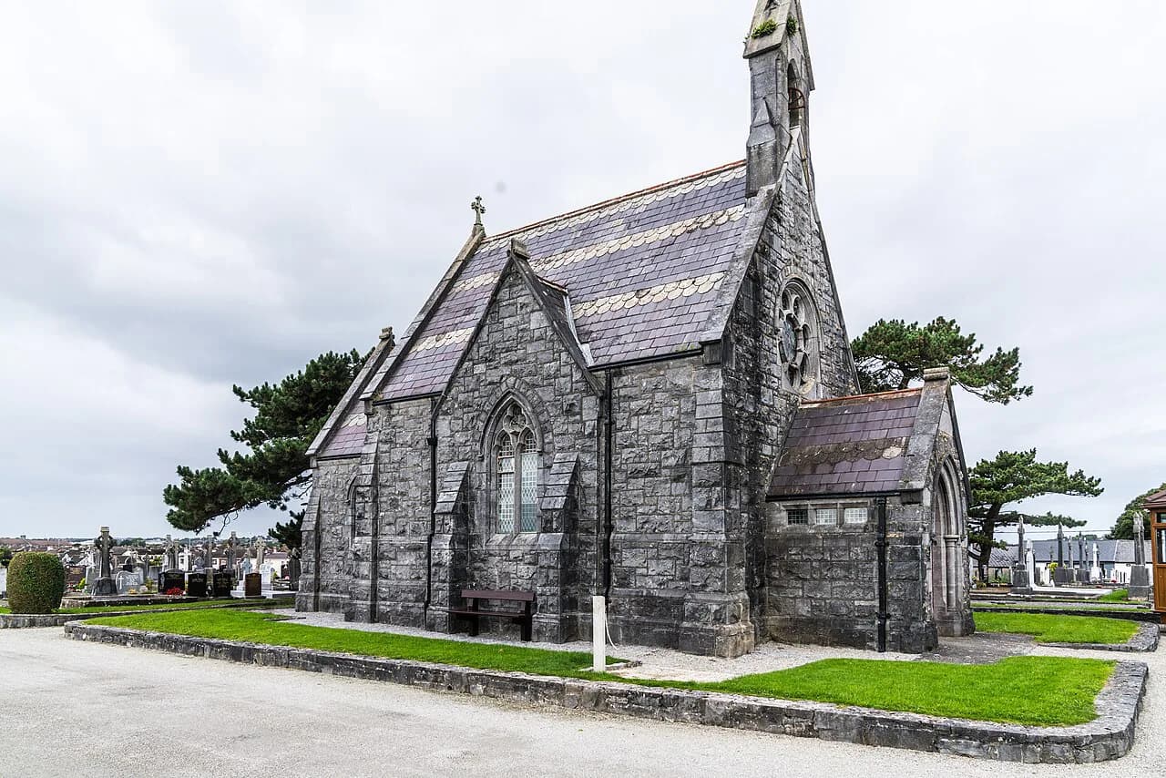
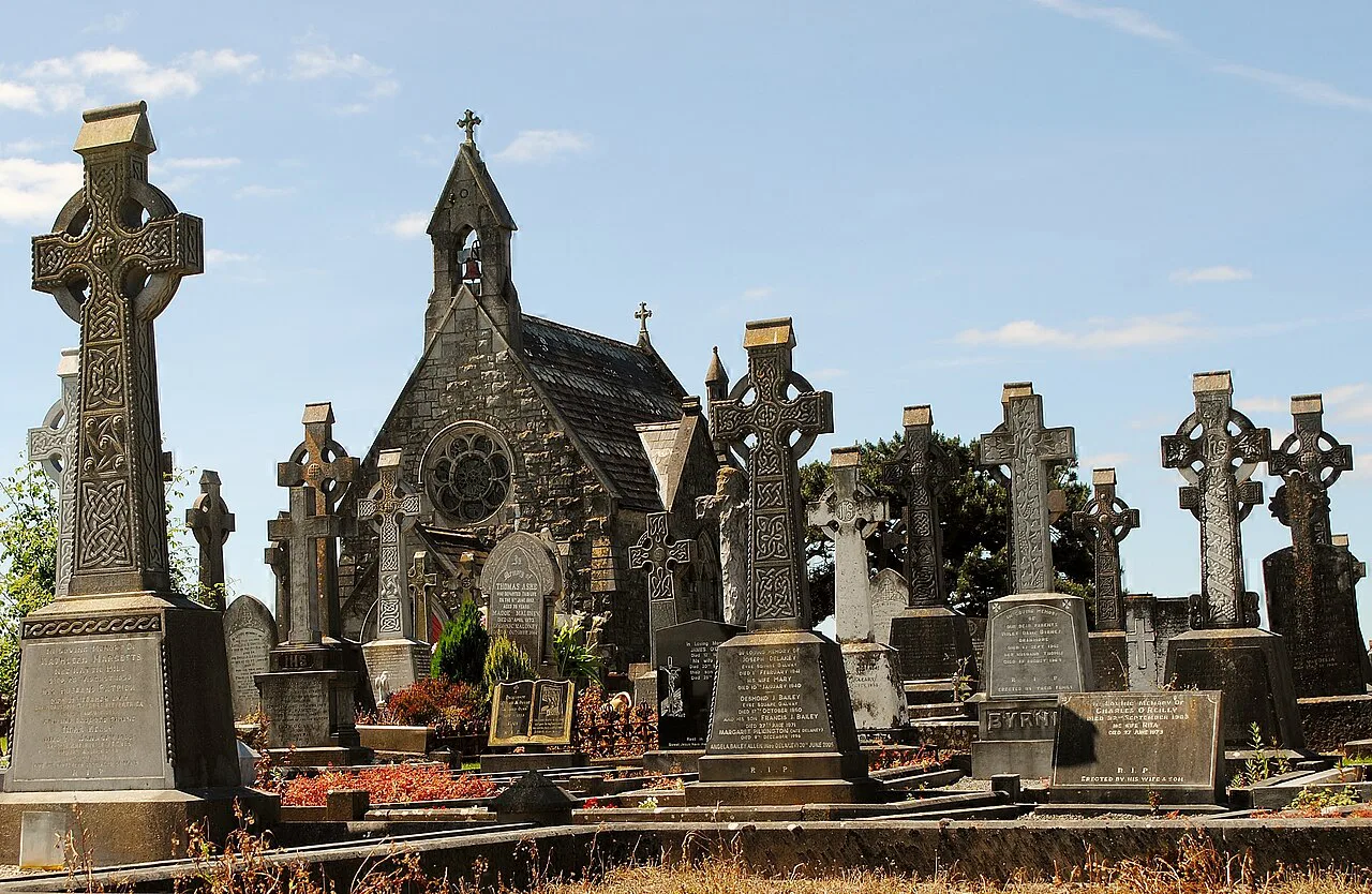
The historical account records two mortuary chapels, the western one reserved for Catholic use and the eastern one for Protestant use. It does not establish that either chapel is open or in use today, so admire the structures from outside rather than expecting an interior visit.
The same account notes a shift in memorial taste: ostentatious Victorian monuments with classical urns and columns gradually gave way to plainer markers after the First World War and its losses. Walking the rows, that change in style is one of the most legible things to look for.
Among those the Advertiser piece lists as buried here are Lady Gregory, Pádraic Ó Conaire, Walter Macken, Arthur Colahan, George MacBeth and William Joyce. It also records 17 Commonwealth burials from the 1914–18 war and three from 1939–45. The cemetery has no published grave map or tour in these sources, so treat these as names to look for rather than fixed locations.

Practical Access to the New Cemetery at Bohermore
Galway City Council publishes main gate hours for both its cemeteries: Monday to Thursday and Saturday 8:00 to 16:00, Friday 8:00 to 15:00, and Sunday 13:30 to 16:00. Pedestrian side gates at both cemeteries are described as open at all times, and no burials take place on Sundays. Hours were checked in October 2026 and can change, so confirm on the council page before setting out; Woodquay is a historic district nearer the city centre if you want to extend a walk through old Galway.
The council also notes that Bohermore holds urn-specific graves only, with standard single graves at Rahoon. That, together with the fact that graves are only sold at the time of death for immediate use, helps explain how the two council burial grounds differ in function.
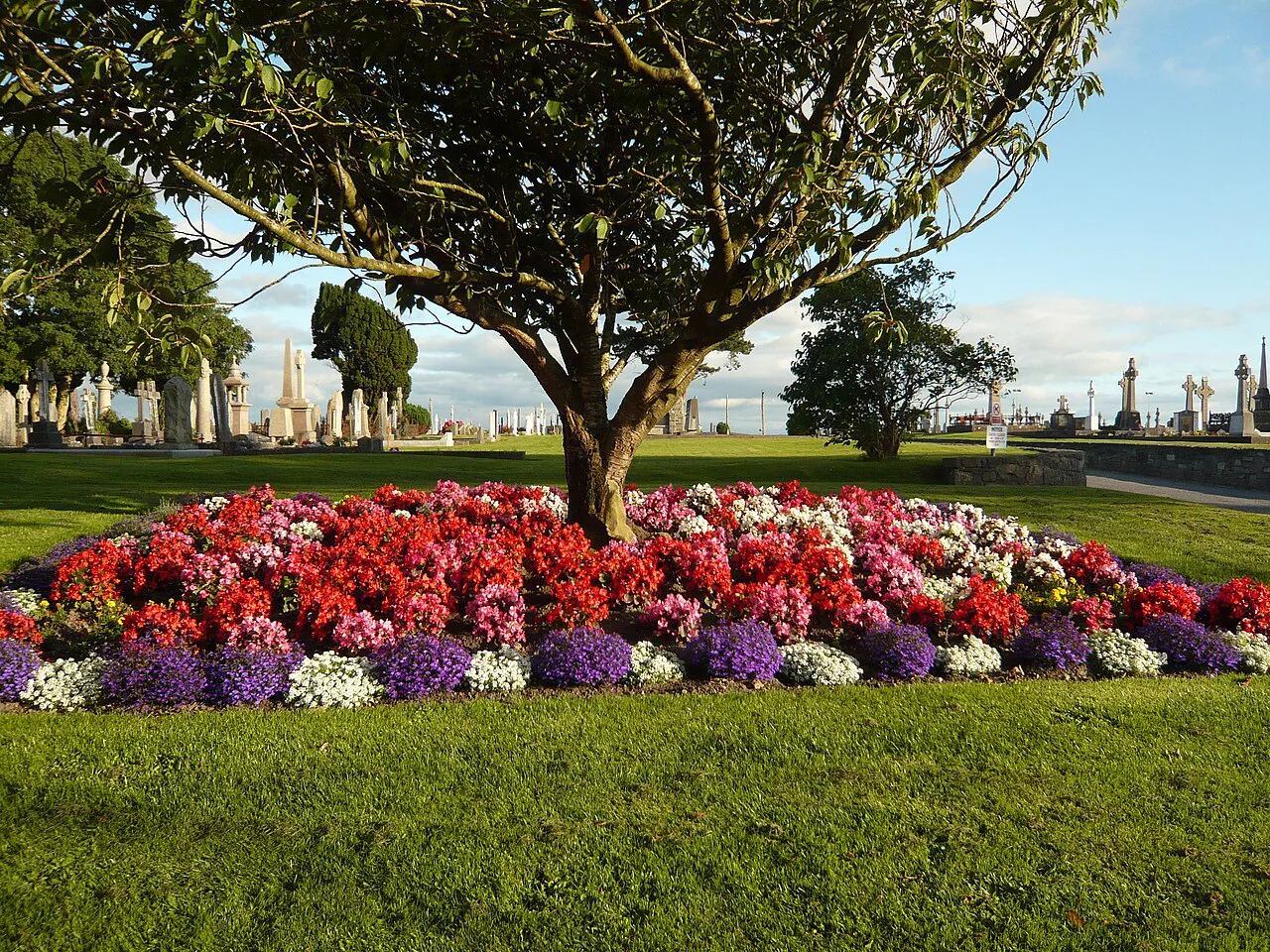
This is an active burial ground rather than a heritage attraction, so keep to paths, give way to funerals and mourners, and avoid treating graves as sightseeing stops. The council's 2023 Code of Practice is an operational document for plot owners and funeral directors, not a visitor code, but the ordinary courtesy of a working cemetery still applies.
Twentieth-Century Transformation: Terraces, Reservoir and Hat Factory
Kenny's essay records a reservoir measuring 155 by 200 feet built at Pumpeen Lane in 1872, and the building of the terraces beginning in 1934. Those terraces carry their own stories in their names: St Finbarr's because construction started on his feast day, St Anthony's for Dean Considine who turned the first sod, and others for a council chairman, James Connolly, a 1916 leader, and a local TD.
The same account says many residents came from tenements in Augustine Street and from the Aran Islands and the Claddagh, that a hat factory opened in 1936, and that the Coole Park Estate was built in the late 1970s. These are historical notes: do not assume the school, factory or reservoir survives in its old use or is open to visitors.
For context on the Claddagh side of that migration story, the neighbouring district guide to the Claddagh, Galway covers the old fishing village on the west bank of the Corrib, which helps place where some Bohermore families came from.
Community Life: The Bohermore Ladies Club
In 1982 Sister Maura Winston of the Little Sisters of the Assumption started the Bohermore Ladies Club, whose first meeting was held in a room at No. 13 St Finbarr's Terrace. According to Kenny's essay the group organised craft classes and talks, and they have been producing plays ever since; the essay also notes that a book was brought out to celebrate 40 years of the club.
That detail matters for how you read the district: the terraces were not just housing stock but the setting for a durable parish social life, recorded in St Patrick's Parish Magazine and in the club's own long run. It is a reason to look at the street names and terrace fronts as part of the story rather than passing through without noticing.
Combining the Walk with the Wider City
A sensible route starts near Eyre Square, follows the old line east to Cemetery Cross, and finishes at the cemetery gates, giving you the road, the terraces and the burial ground in one continuous walk. Because the sources here establish no tours, parking or facilities, plan on the assumption that you are walking an ordinary working street.
Bohermore makes a strong contrast with the city's older core, so pairing it with a walk through the Latin Quarter Galway gives you two very different layers of Galway in a day. For a wider set of area options, the guide to Galway Neighborhoods: 5 Area Guides sets Bohermore alongside the rest.
If you want a change of scene after the road and the graveyard, Salthill, Galway offers the seafront end of the city, and museums in Galway City cover the indoor collections that Bohermore itself does not.
Bohermore as a Layered Approach Road
Bohermore is best understood as a route with a long memory: an old main road under several names, a 19th-century suburb with a school and a crowded population, the site of a Victorian cemetery, and a 20th-century terrace district with a strong parish life. None of those layers cancels the others, which is what makes a walk here more rewarding than a single stop.
Go with the historical account in mind, check the council page for current gate hours before you rely on them, and treat the cemetery as a working place of burial rather than a visitor site. That combination gives you an honest, useful visit to a district most travellers pass through without noticing.
Explore more Galway guides
Frequently Asked Questions
Where is Bohermore in Galway?
Bohermore is the historic road running east from The Green, now Eyre Square, toward Cemetery Cross, where Bohermore Cemetery stands. It is a district rather than a single sight, best covered on foot from the city centre outward.
When did Bohermore Cemetery open?
The historical account in the Galway Advertiser dates its opening to 1873, while Tom Kenny's local history essay gives 1880. Because the two accounts differ, the 1870s is the safer frame than a single founding year.
Can you visit Bohermore Cemetery, and when are the gates open?
It is an active council cemetery, so visits are possible but should respect funerals and mourners. Galway City Council publishes main gate times by day and notes that pedestrian side gates are open at all times; check the council page before travelling, since published times can change.
Who is buried in Bohermore Cemetery?
The Advertiser history lists Lady Gregory, Pádraic Ó Conaire, Walter Macken, Arthur Colahan, George MacBeth and William Joyce, along with Commonwealth war burials from both world wars. No published grave map is available in these sources, so treat the names as a starting point rather than precise locations.
Why was the New Cemetery sited at Bohermore?
Galway's older graveyards were overcrowded by the later 19th century, and a site outside the built-up city on Bohermore was chosen, with a recommendation from Bishop McEvilly weighing heavily in the decision. The land was bought from the Erasmus Smith School board.
What was Bohermore like before the 20th century?
Local history describes a busy road with hundreds of houses by 1812, a boys' school registered in 1852, and a main route in and out of town. It was a working residential district, not simply the approach to a graveyard.
How long should a walk through Bohermore take?
Plan a half-day for the road, the terraces and the cemetery, walking one way from near Eyre Square to Cemetery Cross. The sources establish no tours, facilities or parking, so build in time to check gate hours and to walk back or arrange your own onward route.