
Irishtown, Limerick: A Guide to the Old Suburb and John's Square

Irishtown, Limerick is the historic mainland suburb that grew south from Baal's Bridge, on the far side of the Abbey River from the old walled town, and it is best understood as one of the city's three historic towns rather than as part of King's Island or the later Georgian grid. Its spine is the Broad Street and John's Street axis, and its set-piece is John's Square, laid out in the mid-eighteenth century. This guide stays within that district and treats the streets, the square and St John's Cathedral as things to read rather than tick off.
Where Irishtown Lies in Limerick
The Royal Irish Academy's historic towns atlas is clear that Limerick's historic core is a composite of three settlements, and that Irishtown is the late medieval extension southwards onto the mainland from Baal's Bridge, while Englishtown occupies King's Island and Newtown Pery is the eighteenth- and nineteenth-century rectilinear addition along the Shannon's left bank. That distinction matters on the ground: Irishtown's streets bend to medieval routes, whereas Newtown Pery's are ruled in straight lines.
The atlas locates the earliest southern settlement along the Broad Street and John's Street axis, which remains the readable route through the district. Walk this line and you are following the suburb's own medieval spine rather than a modern tourist corridor. To compare the neighbouring districts and see how this area fits the wider city, start with the Limerick Neighborhoods overview before committing a day to one quarter.

A Suburb Shaped by Defence
Irishtown's location was strategic before it was residential. The atlas explains that the area around Baal's Bridge controlled access to the south and east, and that the bridge served as the entry point to the southern suburb, an area crucial to the town's defence. A wooden bridge existed there before 1176 and was probably replaced in stone between 1360 and 1400, by which time it carried houses.
That defensive logic produced layers of masonry along the approach. The atlas records that an earlier stone wall near the bridge was replaced, probably around 1400, by a more elaborate entrance gate linked by a short lane to West Water Gate, a double gateway with an internal barbican whose outer part was flanked by two D-shaped towers shown on sixteenth-century maps. Nearly nothing of this survives above ground for a casual visitor to point at, so treat the atlas maps as the way to reconstruct what the streets once carried.
Older Layers Underfoot
Archaeology gives the district a depth the surviving buildings cannot. The atlas notes evidence of thirteenth-century settlement and industrial activity in Broad Street, and further south in John's Street, remains of tanning pits, kilns and cess-pits were found. These are not exhibits: they were excavated features, so what you see today is the street pattern those workshops fed, not the workshops themselves.
The suburb also had a violent early history. The atlas records the burning of the suburbs during the Bruce invasion in 1316 and again in 1331 by the first earl of Desmond, which suggests the area south of Baal's Bridge was already developed before those fourteenth-century crises. For visitors, this is a reminder that Irishtown's calm Georgian appearance sits on top of repeated destruction and rebuilding rather than a single continuous medieval fabric.
The city's architectural conservation record adds a scheduling dimension. In its John's Square and Irishtown area it notes recorded monuments including the medieval city walls and the citadel, alongside twenty-three structures the National Inventory of Architectural Heritage identifies as being of regional significance within a relatively small area. That concentration is the strongest argument for walking the district slowly.

The Eighteenth-Century Remaking: John's Square
Irishtown's best-known set-piece arrived in the 1750s. The atlas records that the first significant development was Edmund Sexten Pery's building of a square of stone houses south-west of St John's Church between 1751 and 1756, possibly designed by Francis Bindon, and that surviving building accounts show Boherbuoy to the south-west was occupied by labourers in tied cottages employed on the project. Note the hedge on the designer: the atlas treats the Bindon attribution as possible, not settled.
The city followed the square. The atlas notes that in 1760 the walls were demolished to open southerly access to the new square and a new street, later Gerald Griffin Street, was laid out, with dismantling proceeding through the 1760s. The council's conservation record calls John's Square a formal late eighteenth-century urban square and, in its own assessment, a precursor on a grander scale of the later formal street layout at Newtown Pery. Read that as the council's characterisation, while the atlas dating keeps the square's origins in 1751 to 1756 rather than at the century's end.
Reading the Square Today
The conservation area record describes the physical square you can walk around: a centrally located formal square surrounded by three-storey-over-basement symmetrical townhouses in stone-cut limestone, with an ornate Gothic Revival fountain and the church and graveyard associated with St John's. Be careful with names here, because the record's labelling of the square's church as Roman Catholic is not reliable. The former St John's Church on the square is a separate building from the Catholic St John's Cathedral, and neither should be confused with the other.
The square is lived in, not preserved as a museum set. The conservation record lists historic uses that included residences, religious institutional buildings and associated accommodation, a hospital, a warehouse and a dispensary, with modern uses including workshops, artist studios, dance studios, local retail, residences, a hospital, office and commercial space. Treat the terraces as private property viewed from the street, and do not expect to enter the townhouses or St John's Hospital complex.
For a sense of how this district differs from Limerick's other historic quarters, the Medieval Quarter lies across on King's Island and centres on the Englishtown street pattern and its landmark buildings, so a short comparison helps fix what is genuinely Irishtown. The [medieval quarter limerick] guide covers that ground.
St John's Cathedral: A Separate Landmark
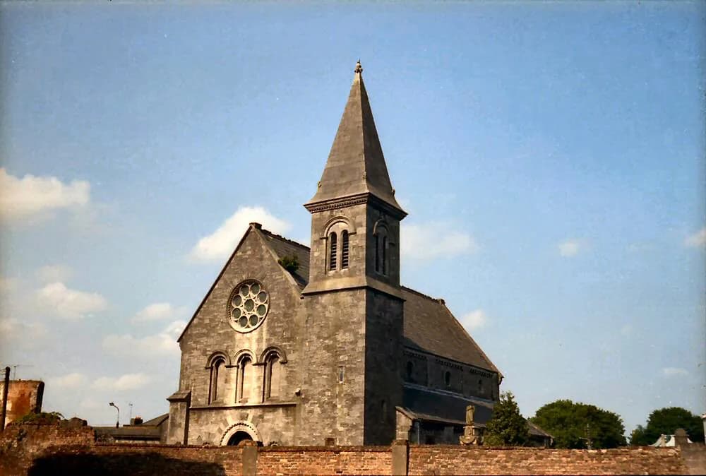
The Catholic St John's Cathedral stands in Irishtown as a nineteenth-century building, and its own diocese sets out the sequence. It was designed by the English architect Thomas Hardwick, its foundation stone was laid in May 1856, the building was roofed by March 1859 and the first mass was celebrated then, while the Limerick firm of Messrs Hennessey was commissioned to design the tower, completed in 1882. The cathedral was consecrated in June 1894 by Bishop Edward Thomas O'Dwyer.
Later work reshaped the fabric. The diocese records three major programmes of reconstruction, one in the 1950s and a second beginning in 1977, with a third restoration completed in June 2003 after two years. Floodlighting installed in 1986 was replaced during the 2003 restoration, which explains why the spire reads so strongly against the night sky from the city's approaches.
The fittings are specific enough to look for if you do get inside. The diocese describes the cathedra, or bishop's chair, and the chapter stalls as carved in Munich in 1894, an altar whose table is Limerick marble with an alabaster and coloured marble substructure, and six bishops buried in the cathedral, including Bishop Ryan and Bishop O'Dwyer in the main aisle before the high altar. The diocese site's operational notices section carried no visitor information, so check the cathedral's own website for current access before planning around the interior.
The Tower and the Skyline
The tower is the district's vertical landmark. The diocese gives the spire as 265 feet 9 inches from the base of the tower to the top of the cross, and states that the tower was designed in 1878 to stand at 274 feet 9 inches on walls some four feet thick, with the spirelettes at the top of the tower and base of the spire themselves thirty feet high. The limestone for the tower was quarried at Rosbrien.
The diocese notes that the spire presents itself from each approach to the city, standing against the horizon or nestling against the backdrop of the Clare hills. Picking it out from a distance can help you locate the district before you arrive on foot and orient yourself within Irishtown.
Walking the District
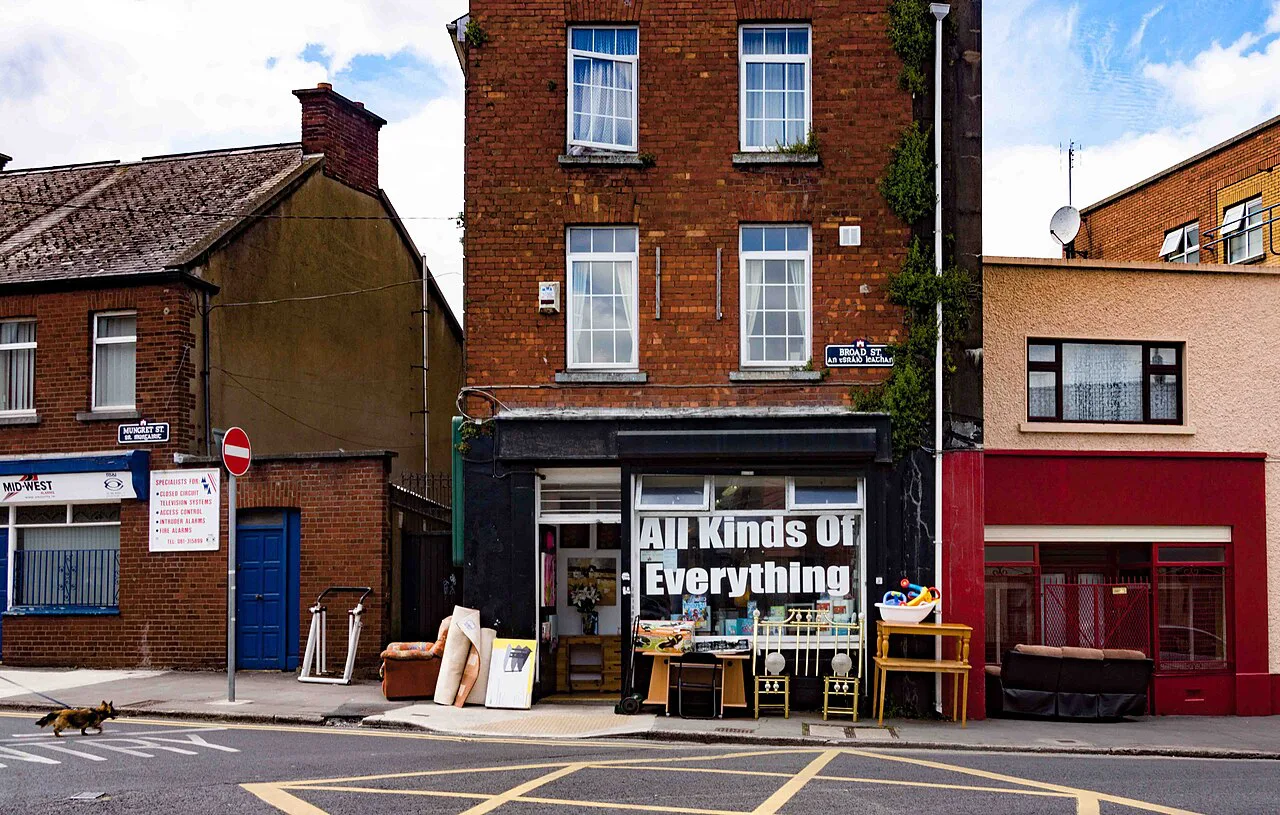
A sensible route follows the atlas geography rather than turning the article into a city-wide itinerary: come over at Baal's Bridge, follow Broad Street into John's Street, and finish at John's Square to read the limestone terraces and the fountain against each other. Look for the change in street line where the medieval axis meets the formal square, because that contrast is the district's story in built form.
Expect a compact area best taken slowly, with no ticket to buy and nothing to queue for. The trade-off is that most of what you will see is publicly visible urban fabric, so you need to read facades and street lines rather than follow exhibition panels. If you want a collection-led visit instead, the museums in Limerick guide points to indoor options elsewhere in the city.
Because the district is small, it combines well with other quarters on foot. Limerick's Georgian Quarter (Newtown Pery) is the planned rectilinear grid that the council record, in its own assessment, casts John's Square as a grander-scale precursor of, so walking both makes the formal street design legible; the Georgian Quarter, Limerick guide covers that side of the city. For other districts across the river, Thomondgate, Limerick sits on the opposite bank and gives a different historic-street experience.
If you would rather plan the district around individual stops than streets, the Limerick Attractions: 10 Visitor Guides collection covers named places across the city, though not everything it lists is within Irishtown. All the same, Irishtown rewards the simplest approach: a couple of hours on foot, the atlas maps in mind and the cathedral spire as your reference point. As with any historic place of worship, verify access before travelling to see the interior.
Plan Your Visit
Irishtown is Limerick's late-medieval mainland suburb, and the most rewarding way to see it is on foot along Broad Street and John's Street, ending at John's Square. Expect Georgian townhouses, a Gothic Revival fountain and the cathedral spire rather than ticketed attractions. Check the cathedral's own site for access to the interior before you go.
Frequently Asked Questions
Is Irishtown the same as Limerick's medieval old town?
No. Irishtown is the late medieval suburb that grew on the mainland south of Baal's Bridge, while the old walled town, Englishtown, occupied King's Island. They are distinct parts of the city with different street patterns, and Newtown Pery is a later Georgian addition again.
What is there to see in Irishtown, Limerick?
The main things to see are the street axis of Broad Street and John's Street, the Georgian set-piece of John's Square with its limestone townhouses and Gothic Revival fountain, and the spire of St John's Cathedral. Most of what you see is public streetscape; the townhouses and St John's Hospital complex are private.
When was John's Square in Limerick built?
The Royal Irish Academy's historic towns atlas dates the square of stone houses south-west of St John's Church to between 1751 and 1756, built under Edmund Sexten Pery. Francis Bindon is described as the possible designer rather than a settled attribution.
Who designed St John's Cathedral in Limerick?
The Catholic cathedral was designed by the English architect Thomas Hardwick, with its foundation stone laid in May 1856, according to the Limerick Diocese. The tower was designed by the Limerick firm Messrs Hennessey and completed in 1882.
Can you go inside St John's Cathedral?
The diocese's cathedral page gives no visitor hours or access details, so check the cathedral's own website before travelling. The interior holds the Munich-carved cathedra and stalls of 1894, a Limerick marble altar and the graves of six bishops, but access depends on current arrangements.
How long does it take to walk around Irishtown?
The district is compact, so a few hours on foot is enough to cover Broad Street, John's Street and John's Square at an unhurried pace. There are no ticketed sites to plan around, so the time you spend depends on how closely you read the buildings and street lines.