
Thomondgate, Limerick: Walking a Historic Shannon District

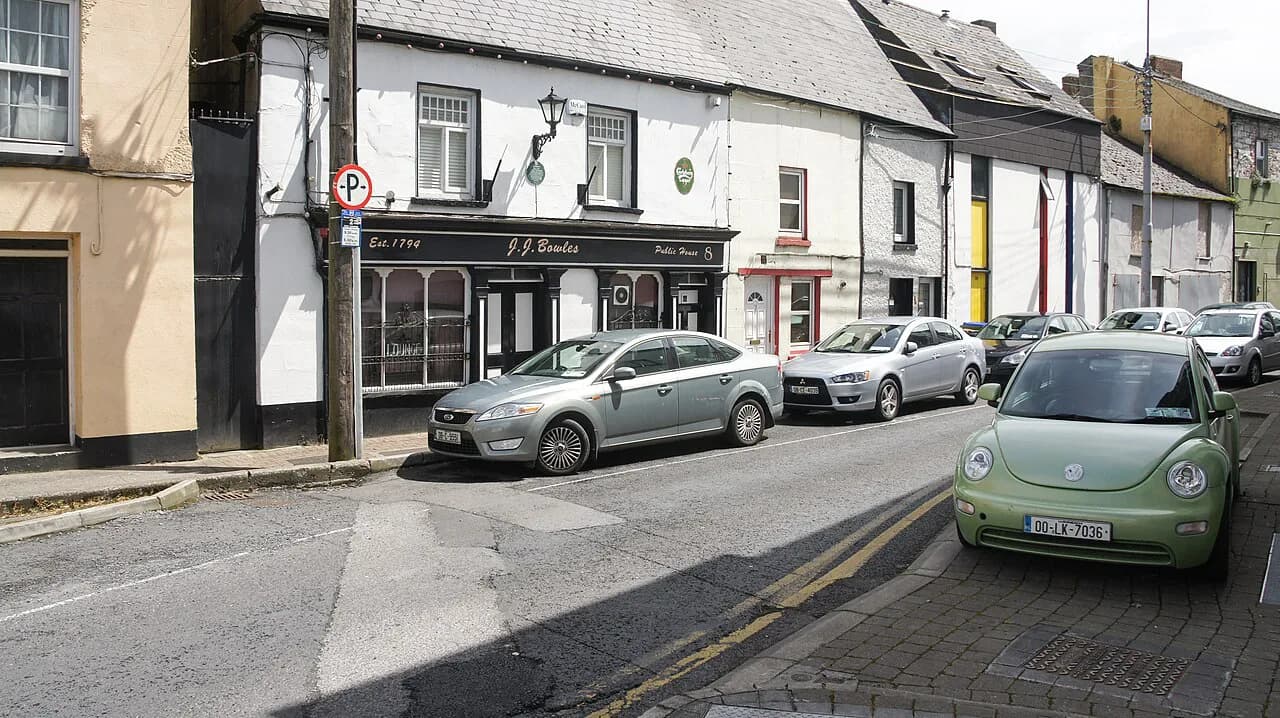
Thomondgate is a residential district on the north bank of the River Shannon in Limerick, stretching west of Thomond Bridge toward Thomond Park. It is a place for a slow outdoor walk through historic streets, not a walled heritage complex with tickets and turnstiles, and the landmarks of King's Island sit across the water rather than inside it. Limerick City and County Council describes the community as steeped in history and recognises the area as an Architectural Conservation Area.
Expect ordinary residential streets, old boundary lines and a handful of named survivals rather than a signposted trail. The value of the walk comes from knowing what the placename refers to, how mapmakers recorded fortifications here, and where the Treaty Stone tradition places one of the city's founding stories. Check locally for any changes to access before you set out, since the district is not a managed visitor site.
Where Thomondgate Sits
Orientation is the first thing to fix: Thomondgate lies on the north side of the Shannon, west of Thomond Bridge, opposite the medieval core on King's Island. The council's community profile places it along the river between King John's Castle and Thomond Rugby Stadium, and that pair works as a boundary description rather than a claim that the castle is part of the district. Cross Thomond Bridge from the city side and you are entering the neighbourhood, not leaving it.
To understand what you are leaving behind, it helps to compare the two banks. The castle and St Mary's Cathedral belong to the island's historic core, which is covered separately in the guide to the medieval quarter limerick; treat that as your starting point and Thomondgate as the destination across the bridge. For a closer look at the cathedral itself, St Mary's Cathedral, Kilkenny: A Visitor's Guide shows how one guide frames a comparable medieval church. The route on foot between them is short, so the two halves of a city day fit together naturally.
The district is an open, lived-in residential area without a published visitor centre, so plan on outdoor viewing only. Thomond Park is a recognised landmark at its edge, but its tour and match-day arrangements are separate questions and should be confirmed directly rather than assumed from the street. For the wider set of city neighbourhoods and how they relate, the Limerick Neighborhoods overview is the place to compare areas before choosing a base.


The Name and the Vanished Gate
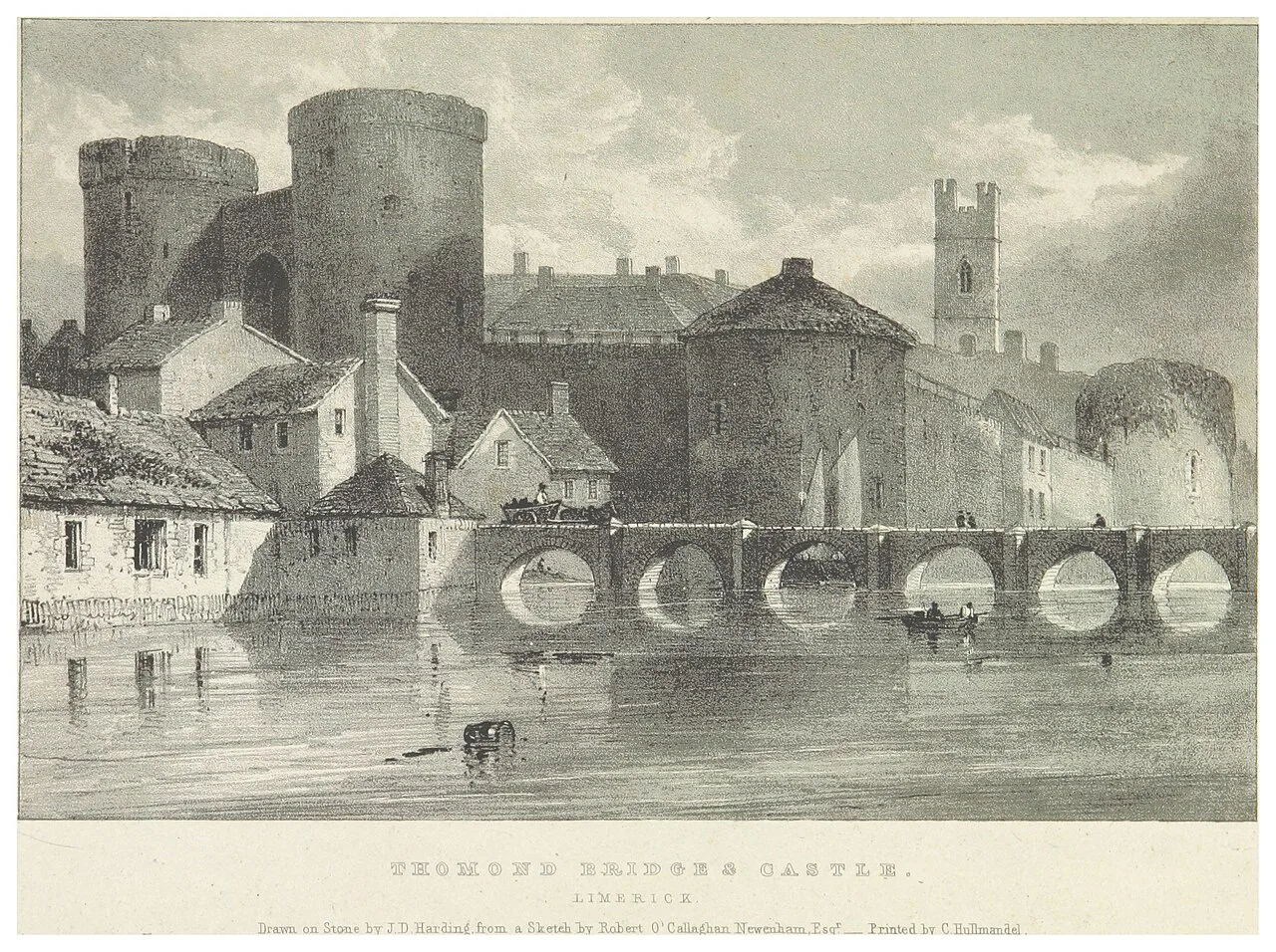
The placename has a precise origin in the city's medieval defences. A licensed excavation report records that the medieval defences included an extramural gate at the western end of Thomond Bridge, and that this gate gave the name Thomond Gate to the area. In other words, the name marks a structure that once stood at the bridgehead, not a surviving monument you can walk up to today.
The same report notes that the gate appears on early town maps, including Hardiman's map of 1590. That cartographic reference is the strongest documentary anchor for the name, and it explains why the district's identity is tied to a bridgehead rather than to a street plan. When you stand near the bridge, you are at the point the name describes, even though the gate itself is not there to see.
Local historian Patrick Comerford adds narrative context in his account of a walk through the district, describing it as one of Limerick's old traditional areas and as the historic link between the Englishtown side of the city and County Clare. That framing is his interpretation of local history rather than an official record, but it usefully explains why a short stretch of riverbank carries so much border history.

Reading Fortifications Through Old Maps
Beyond the gate, the maps show fortification. The excavation report states that Speed's map of 1610 illustrates a star-shaped fort outside Thomond Gate, and that post-medieval earthen fortifications appear again on Greenville's map of around 1640. These were probably developed and altered to withstand the sieges of the city in the seventeenth century, according to the report.
The honest caveat is that the sources do not agree on the details. The same report says little consistency exists among the cartographic sources on the layout and exact location of the earthen defences around Thomond Gate, so any modern attempt to point at a precise spot would be guesswork. Treat the fort as a feature of the map record, not as a ruin to find on the ground.
One suggestive detail is that the modern streetscape around the gate area, including Mass Lane, Castleview Avenue and Halloran's Lane, may reflect the line of elements of those earthworks. The report offers this as a possibility, not a conclusion. Walking those lanes with that in mind is a reasonable way to read the district, provided you do not expect visible banks or walls.
What the 1999 Excavation Found
A test excavation was carried out at Thomond Gate in 1999, with five trenches dug on the location of manhole shafts within the zone of archaeological potential at the western end of the bridge. River gravels or natural boulder clay appeared in every trench, and no archaeological indicators were found above those deposits. The result is a genuine limit of evidence rather than proof that nothing was ever here.
The assessment was confined to the construction corridor of the Main Drainage Scheme, which the report itself says prevented it from shedding further light on the nature of the earthwork defences in the area. Monitoring of all construction work in the zone of archaeological potential was proposed instead. For a visitor, that means the gate and fort are documented in maps and reports, not exposed for inspection.
Streetscape and Conservation Area
The built character is what you can actually read on foot. High Road served as the main street of Thomondgate historically, while a narrow winding street that still carries the Thomondgate name survives within the district, according to Comerford's local account. Look for that distinction between the through-route and the older lane, because it reflects how the area grew.
Official recognition supports the same picture. The council's community profile notes that Thomondgate is recognised as an Architectural Conservation Area, which signals that its historic streetscape is valued as a whole rather than for a single monument. Conservation-area status is a planning designation, not a visitor facility, so it will not translate into signs, gates or opening hours.
Layers of Settlement
Patrick Comerford's narrative sets out several settlement layers, and these are best read as his account rather than independent verification. He writes that the medieval city was confined to Englishtown until Thomondgate and the northern liberties were granted to Limerick in 1216, and that the area sat on the border between Munster and Connacht until County Clare was annexed to Munster in 1602. He also records that County Clare was shired in 1565, which frames the district's long boundary role.
His account continues with the post-Treaty period, when many families of Dutch weavers settled in the area and their trade flourished until the early nineteenth century. He mentions a quarry and a distillery that survived until the early 1920s as further strands of working life. None of these are presented as proven in official sources, so take them as attributed local history that adds depth to the walk.
Landmarks at the Edge
Thomond House is the district's most striking survivor in Comerford's telling, described as an elegant house from the late eighteenth century and one of the few surviving eighteenth-century houses in Thomondgate, with a three-storey, five-bay, gable-ended form. He notes that it once belonged to John Buchanan, credited with organising a regular coach service between Limerick and Dublin. He also states that the building now serves as a women's refuge, so admire the exterior from the street and do not seek entry.
At the Clare end of Thomond Bridge sits the Treaty Stone, the outdoor feature that ties the district to one of the best-known stories in Irish history. According to tradition the Treaty of Limerick was signed on the stone on 3 October 1691, in sight of both armies at the Clare end of Thomond Bridge, and the council presents this as tradition rather than proven fact. The stone has rested on a plinth there since 1865, when the pedestal was erected by Mayor John Richard Tinsley.
The same council page records that the stone lay for some years on the ground opposite its present position, near where the old Ennis mail coach left from the Clare end of the bridge. That detail is a reminder of how much the bridgehead has changed around a fixed object. The stone and bridge are publicly viewable outdoor features, and no ticketing or interior access is recorded for them.
Present-Day Character
The district is not only a historical relic; the council's community profile records recent streetscape and environmental work that shapes how it looks today. These initiatives include biodiversity planting, artistic street enhancements with murals and decorated bollards, a climate action programme adding native Irish trees and hedging, and a remembrance garden honouring a late resident. All of this is community activity within a conservation area rather than a formal attraction.
The same profile notes recognition in the Going for Gold competition, and it was written to introduce the groups representing Limerick in a Pride of Place competition, so it should not be read as a permanent events calendar. Look for the murals and planting as you walk, but do not plan a trip around a specific programme. If you want an indoor collection during your city day, the museums in limerick guide helps you match a rainy hour with a suitable venue.
Walking Thomondgate
The sensible route starts at Thomond Bridge and heads west along High Road toward Thomond Park, watching for the older lane that carries the Thomondgate name. Read the bridgehead for the Treaty Stone tradition, the streets for the conservation-area fabric, and the map record for the gate and fort that no longer show above ground. Keep expectations low for spectacle and high for layered history.
Because this is a residential area, walking quietly and respecting private property matters more than covering distance quickly. No source establishes visitor facilities, guided tours or interior access for the named buildings, so plan an outdoor walk of an hour or two and verify anything you intend to rely on directly with the venue or the council. The Limerick Attractions hub is useful for building the rest of the day around this district.
Plan Your Visit
Thomondgate rewards travelers who arrive knowing what they are looking at: a conservation-area residential district whose name comes from a vanished medieval gate, whose fortifications survive mainly in maps, and whose bridge end carries the Treaty Stone tradition. Walk it on foot from Thomond Bridge toward Thomond Park, keep the King's Island landmarks across the water, and treat the named houses as streetscape rather than attractions.
Pair the district with the wider city by comparing neighbourhoods first, and by placing the medieval core and the Georgian Quarter on separate legs of your day so the walking routes do not blur together. The georgian quarter limerick guide covers later city fabric on the other side of the river, which balances the medieval and early modern layers you will find here.
Explore more Limerick guides
Frequently Asked Questions
Where is Thomondgate in Limerick?
Thomondgate is on the north bank of the River Shannon, west of Thomond Bridge, running toward Thomond Park. Limerick City and County Council describes it as lying along the river between King John's Castle and Thomond Rugby Stadium. The castle sits across the bridge on King's Island, so use it as a boundary reference rather than part of the district.
Is Thomondgate inside the medieval city?
No. The medieval city core, including King John's Castle and St Mary's Cathedral, is on King's Island across Thomond Bridge. Thomondgate developed outside that core, and a licensed excavation report explains that its name comes from an extramural gate at the western end of the bridge, meaning a gate outside the main defences.
Can you see the old Thomond Gate today?
There is no documented surviving gate to visit. The excavation report identifies the name's origin in a gate shown on early maps such as Hardiman's 1590 map, and a 1999 test excavation limited to a drainage corridor found no archaeological indicators. Treat the gate as a documented feature of the map record rather than a visible monument.
What is the Treaty Stone connection to Thomondgate?
The Treaty Stone stands at the Clare end of Thomond Bridge, at the edge of the district. Limerick City and County Council states that according to tradition the Treaty of Limerick was signed on the stone on 3 October 1691, and that the stone has rested on a plinth there since 1865. It is a publicly viewable outdoor feature.
What should you look for on a walk through Thomondgate?
Follow High Road toward Thomond Park, look for the older winding lane bearing the Thomondgate name, and read the streetscape of an Architectural Conservation Area. Murals, planting and decorated bollards recorded by the council give the area its present character. Thomond House, described by local historian Patrick Comerford as a rare surviving eighteenth-century house, is a private building to view from outside only.
Are there tours or opening hours for Thomondgate's landmarks?
No council or venue publication establishes tours, opening hours or interior access for the Treaty Stone, Thomond House or local churches. The Treaty Stone and bridge are outdoor features, and the district is an open residential area. Check directly with Limerick City and County Council or the relevant venue before relying on any scheduled access.