
Spanish Arch, Galway: Reading a Fragment of the Town Wall

The Spanish Arch in Galway is a fragment of the city's old riverside wall, standing on the left bank of the River Corrib at the Claddagh edge of the centre. You can see it in passing in minutes, but it rewards a slower look once you know what the documentary record says about its names and uses. This guide keeps to the record and explains how to read the stonework on a short stop.
Where the arch stands
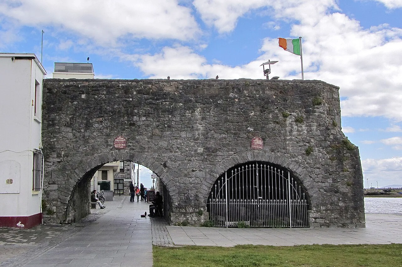
The arch sits on the left bank of the River Corrib where the river opens toward the sea, at the Claddagh end of the old town. Galway Tourism places it in that riverside setting, with the Long Walk and Middle Arch in the immediate surroundings. That position is the key to understanding it: this was a gateway tied to the water, not a decorative park ornament.
Galway City Museum now occupies a building about 50 yards from the arch's former museum use, according to the same local tourism account. That makes the arch easy to pair with the museum's indoor collections on the same walk. Treat the two as separate stops rather than assuming the arch itself has galleries or facilities.
Approaching on foot from the medieval street network, the arch appears suddenly at the water's edge, framed by the low riverside wall and the open sky over the Corrib. Use it as a hinge between a walk through the older streets and a stretch along the riverbank. The wider Galway guide sets out how the surrounding sights fit together.

What survives and what it was
The Royal Irish Academy's Irish Historic Towns Atlas records the structure as Ceann an Bhalla, 'the head of the wall', and its earliest entry is a 'place of defence' in 1580–81. That label matters: it identifies the arch as part of the waterfront defences, with an unnamed bell turret recorded by 1583. The atlas chronology, not a popular construction date, is the safest basis for understanding it.
Lonely Planet describes the arch as thought to be an extension of Galway's medieval city walls, designed to protect ships moored at the nearby quay while goods were unloaded. The same account notes that most of the town's walls almost completely disappeared over the following centuries. The arch therefore survives as a fragment of a much longer circuit, not as a stand-alone medieval building.
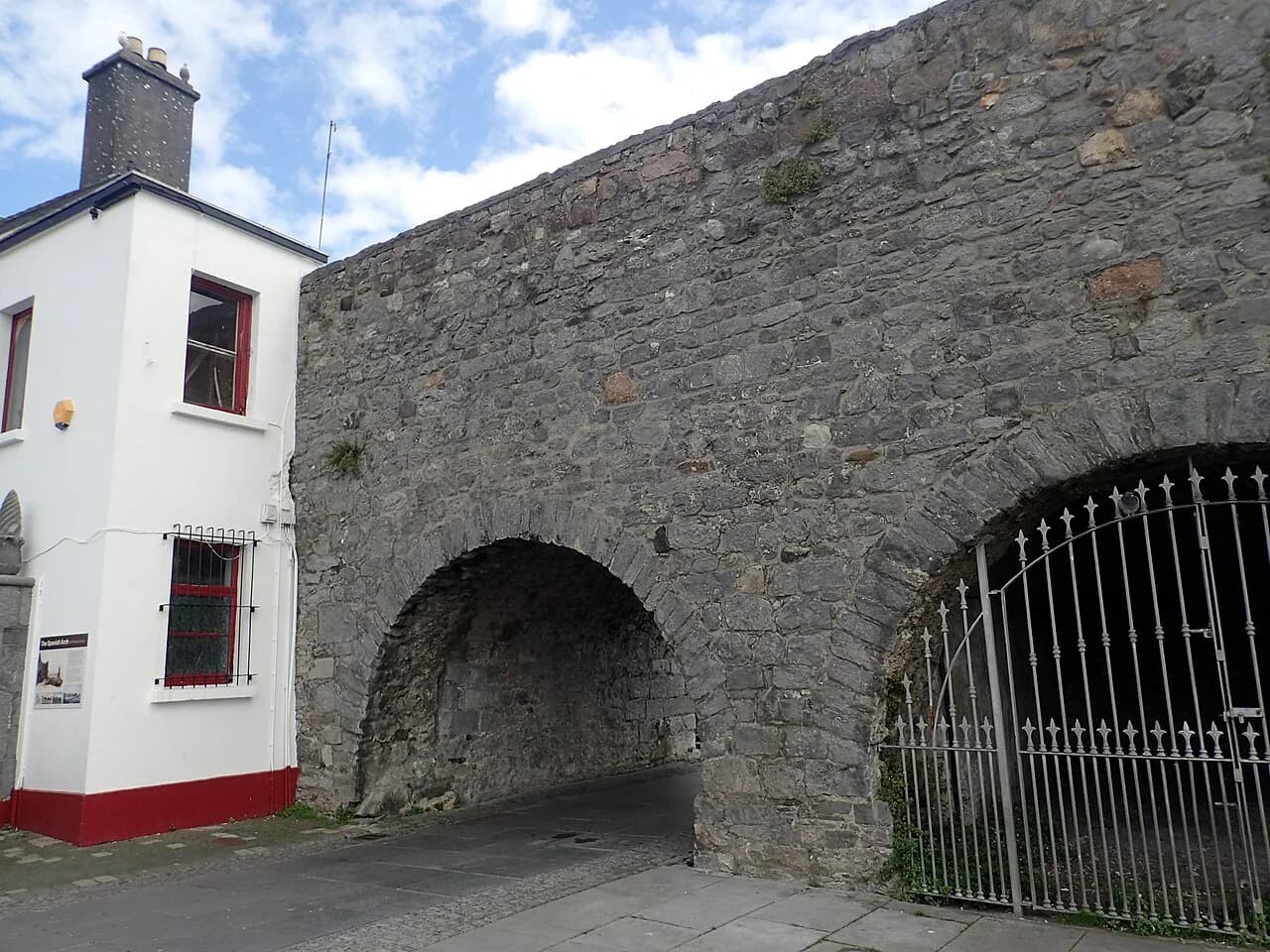
What you see today is not a sealed relic frozen at one moment. The documentary record shows the structure being renamed and reused across centuries — from place of defence to blind gate, open arch and finally Spanish Arch — so the best reading of the stonework is as evidence of long use and changing function rather than a single immutable medieval face.

The documented chronology
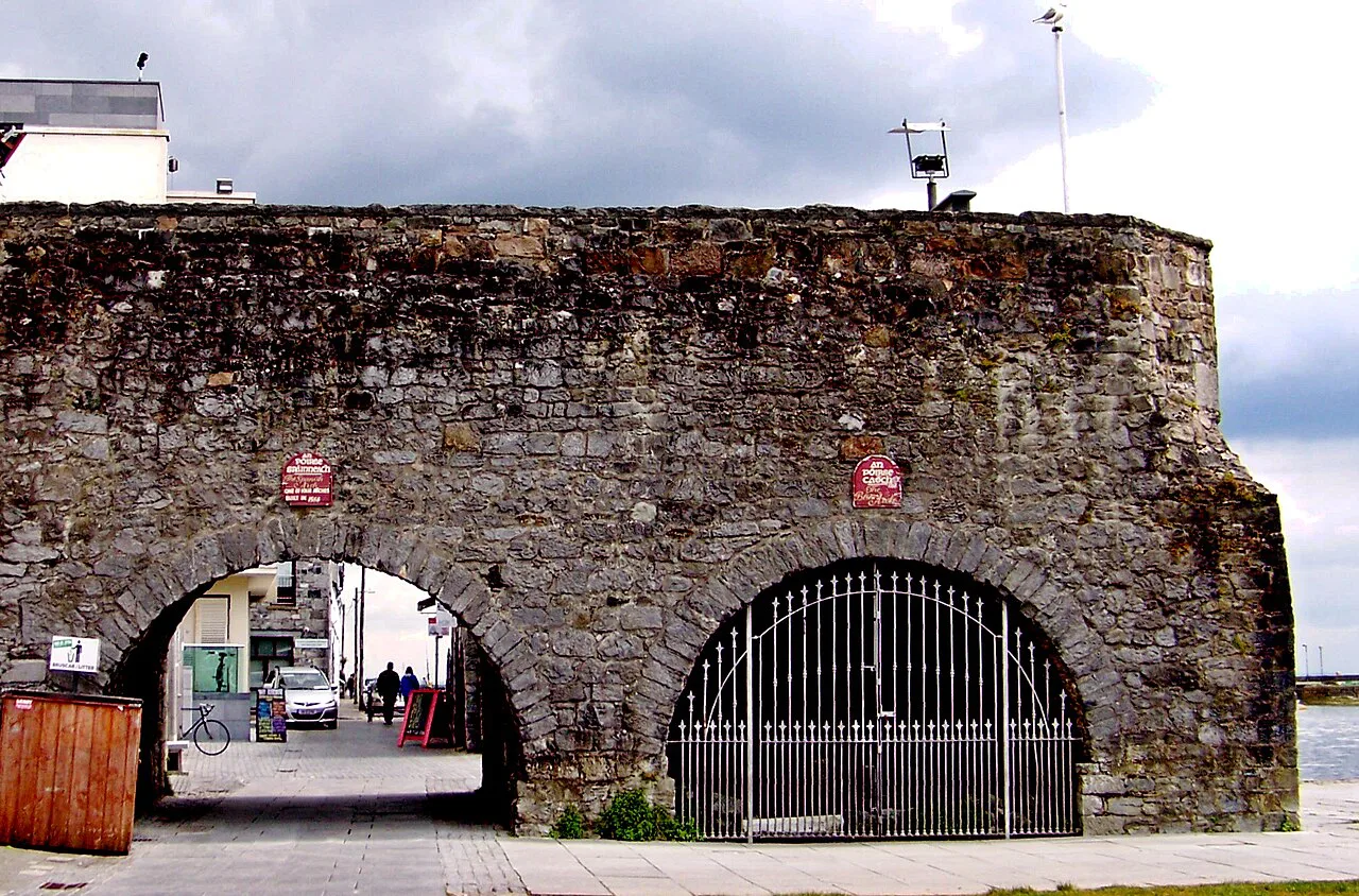
The town atlas follows the names and uses of the structure in sequence: a place of defence in 1580–81, an unnamed small bell turret and a Lerpole Tower in 1583. Later entries mention a blind gate in 1689 and an open arch in 1738, with a great arch in a bastion in 1739. These are documentary labels, not a building schedule, and they show a structure whose role kept shifting.
The same chronology records key and quay bastion references in 1747 and a key flanker around 1755, then town-wall references running through the nineteenth century. Names such as the Old Arch of Town Wall in 1850 and Spanish Arch in 1906 sit within that later stretch. Reading the list as a whole shows a riverside structure repeatedly relabelled as its military and commercial functions changed.
When the name appears
The scholarly chronology records the name Spanish Arch in 1906, while Blind Arch usage continues in later references through the twentieth century and the Spanish Arch name reappears in 2014. This is the firm documentary marker for the familiar name. It should be separated from any explanation of why the name was chosen, which the record does not settle.
Spanish merchant trade with Galway is plausible context for the name, since European ships carrying wine and spices are described as selling goods at the docks in medieval times. But a plausible association is not proof of etymology. Visitors should treat the Spanish connection as background for understanding the port, not as a definitive naming story.
The 1755 tsunami and the present fabric
Lonely Planet reports that the arch was partially destroyed by the tsunami that followed the 1755 Lisbon earthquake. This is a travel account's summary of the damage and its place in the arch's history, not a full engineering record. What matters for the visitor is the consequence: the structure standing by the Corrib has been altered and repaired across later centuries.
The town atlas carries references to a named arch at the site across many phases, from an open arch in 1738 and a great arch in 1739 through to town-wall and arch entries in the nineteenth century. That continuity of changing labels means you should not read the present mass as one single construction phase. Look for patches and joins rather than expecting one consistent medieval face, and the chronology gives you the vocabulary for what you are seeing.
The riverside today
Galway Tourism describes the area under and around the arch as a gathering place, with buskers playing and people using the riverside on sunny days. Lonely Planet notes buskers and drummers at the arch and kayakers negotiating the tidal rapids of the Corrib. These are described activities rather than guaranteed amenities, so treat a performance or a passing kayak as a bonus rather than the reason for the trip.
The Claddagh side of the city places the arch within an open, tidal waterfront rather than a contained heritage site. The river's movement is part of the setting, and the changing water level makes the same spot look different at different times of day. For a sense of the wider district, the neighbourhood guide explains how the Claddagh and adjoining areas connect.
A short visit, shaped
Allow a short pause at the arch itself and plan your day around what you pair with it. No opening hours or ticket prices for the monument appear in the sources used here, so judge it as an open-air riverside stop rather than a booked attraction. The practical decision is how much time to give the arch versus the museum next door.
Pair the arch with the Galway City Museum building nearby, which the tourism account places about 50 yards from the arch's former museum use, and with the old street network toward the city centre. If you want to widen the visit, the adjacent riverfront and a loop back through the medieval streets make a sensible extension on foot. For a longer indoor option beyond the city museum, our guide to museums in Galway weighs up the alternatives, and if you would rather plan the visit area by area, see our guide to Galway Neighborhoods for the surrounding districts.
Reading the wall across the city
The arch makes most sense as a piece of a lost circuit. Lonely Planet notes that one surviving portion of Galway's walls was incorporated into the Eyre Square Centre, and the square itself is a short walk inland from the riverside. Seeing that fragment after the arch shows how widely the defences once spread, and why the riverside gateway is not a complete picture on its own.
The town atlas records how much of the surviving evidence is documentary rather than standing stone, which is why the names and dates in the record tell you as much as the masonry. Carry that idea with you from the arch, then step into the Galway City Museum nearby if you want to go deeper into the city's past.
Making the Stop Worthwhile
The Spanish Arch is a compact monument with a long, well-documented paper trail, and the best visit combines a few minutes of looking with a little preparation. Read the chronology first, then stand by the river and notice how the arch relates to the water, the Long Walk and the nearby museum building. That order turns a quick photo stop into a legible piece of Galway's history.
If you want to see the wider defensive story, walk inland to Eyre Square and compare the arch with the wall fragment preserved there. Pair the riverside stop with a museum visit and a short city-centre loop, and keep the arch as a fragment rather than a destination that needs hours. That balance works well for a first visit to Galway.
Explore more Galway guides
Frequently Asked Questions
Where exactly is the Spanish Arch in Galway?
It stands on the left bank of the River Corrib at the Claddagh end of the old town, beside the riverside walk and close to the present Galway City Museum building, which local tourism information places roughly 50 yards from the arch's former museum use.
Is the Spanish Arch the same as Ceann an Bhalla?
Yes. The Royal Irish Academy's Irish Historic Towns Atlas records the structure as Ceann an Bhalla, meaning the head of the wall, and its earliest entry for the site is a place of defence in 1580–81.
When did the name Spanish Arch first appear?
The town atlas records the name Spanish Arch in 1906, while Blind Arch usage continues in later references into the twentieth century. The name is documented, but the record does not prove why it was chosen, so trade links with Spain remain plausible context rather than a settled explanation.
Was the arch damaged by the 1755 tsunami?
Lonely Planet's account says the arch was partially destroyed by the tsunami that followed the 1755 Lisbon earthquake. Because that is a travel account rather than a detailed engineering record, read the present stonework as repaired and altered over time rather than as untouched medieval masonry.
Is there an admission charge for the Spanish Arch?
The sources used here describe the arch as an open-air public riverside monument rather than a ticketed site with a visitor centre, so treat it as something you walk up to rather than book. Check current local arrangements if you are planning around a specific event.
How long does a visit to the Spanish Arch take?
Treat it as a short stop of a few minutes rather than a half-day destination. The worthwhile approach is to give it a little reading time, then pair it with the nearby Galway City Museum building and a walk through the adjoining streets.
What is there to see near the Spanish Arch?
The adjoining riverfront, the Long Walk and the nearby Galway City Museum building are the obvious pairings, and the old street network toward the centre is within walking distance. Buskers and kayakers are described as common around the arch, but they are activity rather than guaranteed facilities.
Can I see other remains of Galway's town walls?
Lonely Planet notes that a surviving portion of the town walls was incorporated into the Eyre Square Centre, inland from the riverside. Pairing the arch with that fragment shows that the arch is one piece of a larger circuit that has largely disappeared.