Cork Architecture: A Walking Guide to the City's Built Heritage
Cork architecture reflects an island-and-hills city shaped by trade. See the medieval street spine, Georgian terraces and named sites worth visiting on foot.
On this page
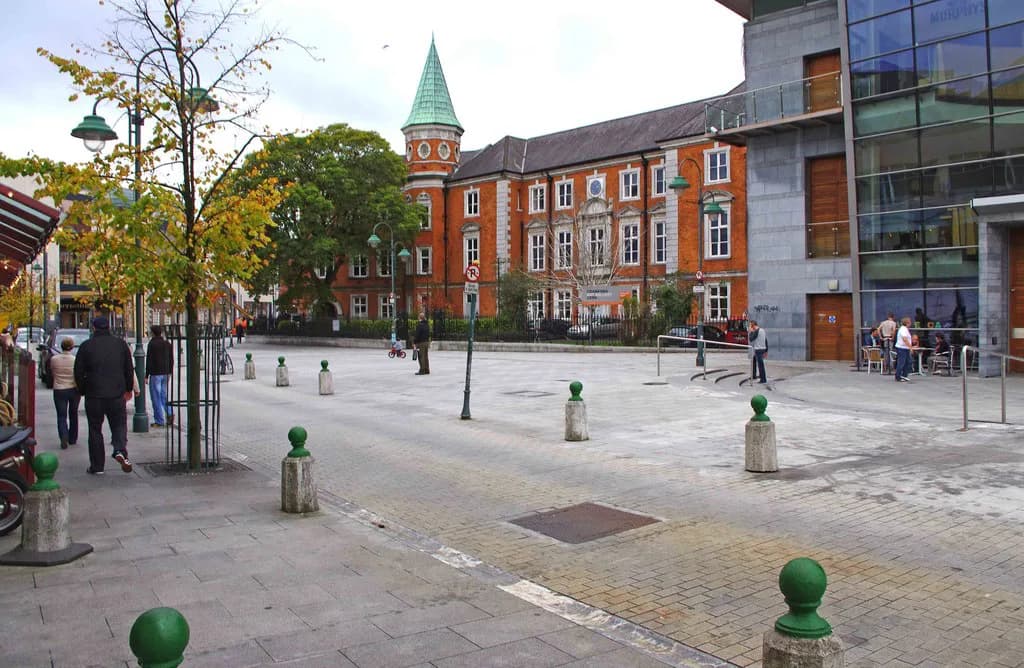
Cork's architecture is best understood as a response to its site: a marshy valley where the River Lee breaks into several waterways, with steep hills rising north and south. Cork City Council's heritage plan describes a city built on estuarine islands and gradually developed up those slopes, and it notes that even the name derives from the Irish word for marsh. That single fact explains a great deal about how the streets bend, where the quays sit, and why so many views are framed by rising ground.
This walk-oriented guide uses the council's own account of the city's development to structure what you look at, then points to named places where that history is legible today. It separates buildings you can enter from monuments whose current use limits access, so you can plan around what is actually visitable rather than assumptions.
Topography First: Why Cork Looks the Way It Does
Start with the ground under your feet. The council's heritage plan explains that Cork grew on estuarine islands within the Lee's marshy valley before spreading up the steep hills to the north and south. Buildings had to answer to water and gradient before anything else, which is why the historic core feels compact and why so many streets change level within a short distance.
The city's long continuity matters too. The same plan traces Cork from a seventh-century monastic foundation associated with Saint Fin Barre through a Viking-era trading settlement to a prosperous port, and describes the heritage as mirroring that continuous change. Treat the phases as layers in the built fabric rather than separate eras: each one reused and rebuilt on the same constrained ground.
Reading the Street Plan: North and South Main Street
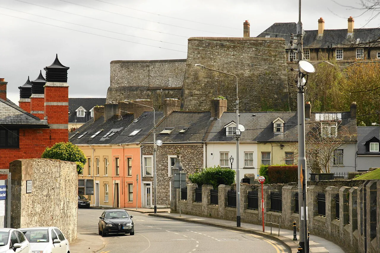
The clearest surviving piece of medieval Cork is not a building but a street pattern. North Main Street and South Main Street together formed the central spine of the medieval city, with laneways and plots running off at right angles toward the line of the city wall. Walk either street and look sideways at the narrow gaps between frontages; those openings preserve the geometry of medieval burgage plots even where the buildings themselves are centuries younger.
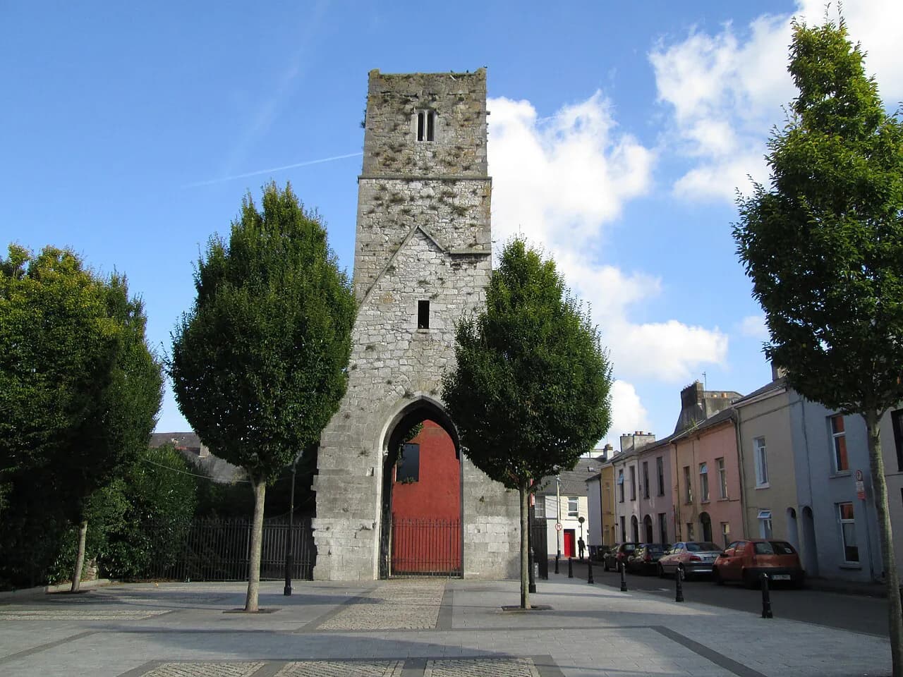
Above ground, very little medieval fabric survives, and the council's plan notes only a few surviving medieval and early post-medieval structures. It names Red Abbey Tower and Elizabeth Fort among them. For visitors that means the street plan carries the medieval story, while the standing monuments are isolated markers rather than a continuous historic townscape.
The Eighteenth to Twentieth Century Layer
Most of the city centre's visual character comes from a later building boom. The heritage plan describes eighteenth- to twentieth-century buildings ranging from villas and country houses on the hills to terraced Georgian-style housing, churches and cathedrals, and more modest single- and two-storey homes built for industrial workers. This is the layer that gives Cork its mix of grand set-pieces and plain streetscapes, and it rewards looking at rooflines and window rhythm rather than only at landmarks. If Georgian terraces and church spires are what you enjoy reading on foot, our guide to dublin architecture offers a parallel exercise in spotting the same period's buildings.
Port wealth left an industrial layer as well. Mills, warehouses, distilleries and breweries survive in the contemporary city as evidence of commercial expansion, and the plan points to the Butter Market in Shandon and the bonded warehouses of the Port of Cork. The Butter Museum, in the same Shandon area, explains the trade that built such mercantile fabric. Some of this layer is best seen as streetscape and skyline; not every warehouse or mill interior is open to visitors, so treat these as buildings to read from outside unless a site publishes otherwise.
St Anne's Shandon: An Early Eighteenth-Century Church
St Anne's Church, Shandon, anchors the north-side skyline and is one of the city's most legible historic buildings. The parish describes it as a Church of Ireland church in continuous worship since 1722 and cites a 2001 architectural appraisal calling it one of the most important early eighteenth-century churches in Ireland, noting that it retains original eighteenth-century bells. The famous four-faced clock is part of the building's identity, but the interior mechanism, not necessarily every dial, is what visitors see when they examine it.
For architectural visitors the church offers something more active than a facade: the parish lists self-guided tours, the chance to play the Shandon Bells, a view of the clock workings and a climb up the tower for panoramic city views. Those are options rather than guarantees at any given moment, so check the parish's current visitor information before making the tower the centrepiece of a day.
It also sits naturally in a wider look at the city's ecclesiastical buildings, which range from early eighteenth-century parish churches to later cathedrals. If churches are a particular interest, our guide to churches in cork sets out which ones reward a detour.
The Butter Museum: Commercial Architecture in Shandon
Shandon's other museum tells the story behind a different kind of building. The Butter Museum occupies the historic Shandon area and interprets the butter trade, including the internationally important nineteenth-century Cork Butter Exchange, the craft of home butter making and the later Kerrygold brand. Read it as a key to the city's commercial architecture: the exchange and the trade it served explain why solid mercantile buildings cluster where they do.
The museum also documents a striking change in scale, noting that Ireland once had more than 150 distinctive butter brands before centralised marketing reshaped the industry. Its opening hours are published by season, and the site states that last admission is 3.30pm; the seasonal pattern is worth checking before you travel. For a wider survey of the city's collections, our roundup of museums in cork puts this one in context.
Elizabeth Fort: A Star-Shaped Survivor With a Caveat
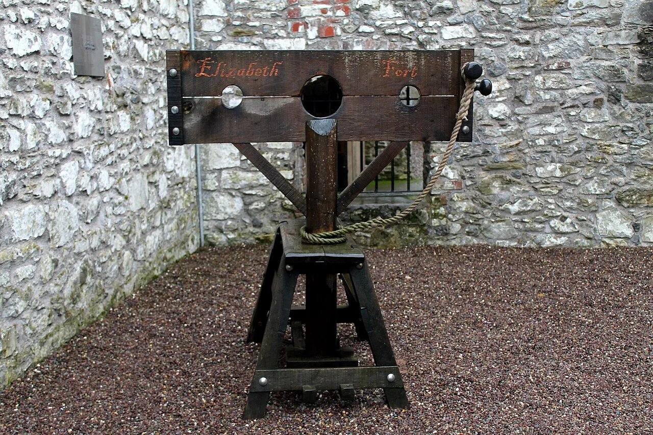
On the south side of the city, Elizabeth Fort is described by the regional tourism authority as one of the finest examples of a seventeenth-century star-shaped fort. Its outline was originally built in 1601 during the reign of Elizabeth I and replaced in 1624 by a stronger fort with essentially the same plan that survives today. That makes it one of the few places where Cork's early modern military architecture can still be read in plan form.
Its later history is a lesson in how Cork's buildings were reused rather than replaced: it served as a British military barracks from 1719, later became a female convict prison, and passed through other uses before the same source records that it is now a Garda station. Visitors should plan on viewing the fort as a landmark in the streetscape rather than assuming open access, and confirm any public arrangements before making the trip.
Cork City Gaol: Castle-Like Nineteenth-Century Building
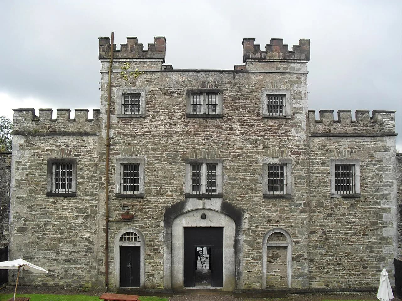
Cork City Gaol at Convent Avenue, Sunday's Well, is the city's most dramatic example of institutional architecture from the nineteenth century. The operator describes a castle-like building that once housed nineteenth-century prisoners, now run as a heritage centre with both guided and self-guided tour options. It is a distinct site from the former Cork County Gaol, so read the name carefully when planning or searching for it.
Architecturally the appeal is the building itself: the scale, the wings and the fortified look tell you how nineteenth-century institutions projected authority. The operator states that tour guides are on hand daily through the year to provide guided tours for groups of ten or more, which is useful to know if you are travelling as a small party hoping for a leader-led explanation. The self-guided route otherwise lets you set your own pace through the corridors.
Putting It Together: Walking Cork's Heritage Trails
The best way to see several layers in one outing is to follow a published route. Cork City Council, with the Department of Transport, Tourism & Sport, developed four Heritage-related walking trails: the Shandon Mile, the South Parish walk, a River Lee bridges walk and a city-centre walk, linking buildings and places of heritage interest. The council notes that the compact centre makes the city easy to explore on foot.
Choose by interest rather than by tick-list. The Shandon Mile covers the north-side streetscape around St Anne's and the Butter Museum, the South Parish route takes in the area around Elizabeth Fort, and the bridges walk is a longer cross-city option focused on the river. Maps are published with the routes, but no walking times or distances are given, so allow your own pace. The Council's route descriptions also reference the academic environs of University College Cork, which sits outside the tightest historic core.
If you prefer a structured introduction before walking independently, a free self-guided alternative is our own cork walking tour route, which can supply the orientation that maps alone do not. The gaol itself is a good case study of institutional architecture if you want to compare interior detail with the street-level reading described above.
Trade-Offs: Building Visits Versus Street-Level Reading
Cork rewards both approaches, but they compete for time. Entering a museum such as the Butter Museum or the gaol gives you interior detail and interpretation; walking the Main Street spine and the Shandon lanes gives you the plan and the layers that no single interior can show. If your time is short, one interior plus one street route is a workable balance.
Access is the other variable. St Anne's and the gaol publish visitable options, the fort is currently a working Garda station, and industrial remains are largely exterior. Plan around confirmed access rather than assuming every building named in a heritage overview can be entered.
Plan Your Visit
Cork's architecture is a record of topography, trade and social change, written in a medieval street plan, eighteenth-century churches, Georgian and workers' housing, and the warehouses of a busy port. Reading it on foot, with the council's trails as a structure, lets you see how those layers overlap in a small area.
Pick your interiors deliberately, check the published arrangements for the gaol and any site where current use matters, and treat the rest as streetscape to be observed. For more collections and indoor stops across the city, browse our guide to museums in cork before you finalise a route.
Explore more Cork guides
Frequently Asked Questions
Is Cork's medieval street layout still visible today?
Yes, chiefly in the street pattern rather than in standing buildings. Cork City Council's heritage plan identifies North Main Street and South Main Street as the medieval spine, with lanes and plots running off at right angles toward the old city wall. Few medieval structures survive above ground, so look for the arrangement of streets and plot boundaries.
Can you visit Elizabeth Fort?
Be cautious about planning a visit. A regional tourism listing describes it as a seventeenth-century star-shaped fort with a 1601 origin and a 1624 rebuild, and also records that it is now a Garda station. That means you should treat it primarily as a landmark and confirm any public arrangements before travelling.
What is there to see at St Anne's Church in Shandon?
The parish, a Church of Ireland congregation, describes a church in continuous worship since 1722 that retains original eighteenth-century bells. It lists self-guided tours, the chance to play the bells, a look at the four-faced clock workings and a tower climb with city views. These are available options rather than guarantees at any moment.
Is the Butter Museum about architecture or about food?
It is about the butter trade, and that trade explains a great deal of Cork's commercial architecture. The museum covers the nineteenth-century Cork Butter Exchange along with home butter making and the Kerrygold story, so it works as a key to the mercantile buildings of the Shandon area as well as a collection in its own right.
How many heritage walking trails does Cork City Council publish?
Four, developed with the Department of Transport, Tourism & Sport. They cover Shandon, the South Parish, a River Lee bridges route and the city centre, linking buildings and places of heritage interest. The council publishes maps but gives no set walking times or distances, so allow for your own pace.
What is the difference between Cork City Gaol and the former Cork County Gaol?
They are separate buildings. Cork City Gaol is the castle-like nineteenth-century former prison at Convent Avenue, Sunday's Well, now operated as a heritage centre with guided and self-guided options. If you are searching for it, check the name and address carefully so you do not end up planning around a different institution.
Do I need a guided tour to understand Cork's architecture?
No, but structure helps. The council's heritage trails and its published account of the city's development give you the sequence of layers to look for. Guided options exist at some sites, while St Anne's offers self-guided tours and the gaol offers both guided and self-guided formats.
Sources
You might also like

Continue reading
More guides you'll find useful