Ringforts in Ireland: Reading Early Medieval Farm Earthworks
Ringforts in Ireland are early medieval farm enclosures ringed by banks and fosses. Learn to read the earthworks and visit Carron Ringfort in County Tipperary.
On this page
A ringfort in Ireland is a circular enclosed farmstead of the early medieval period, usually defined by one or more earthen banks with a ditch outside them, or by a stone wall in western parts of the country. These monuments are among the most common surviving field monuments on the island, which is why they turn up in ordinary farmland rather than only on heritage trails.
They matter to visitors because they are subtle: a ringfort often reads as a low grassy circle rather than a ruin, and the interest lies in learning to see the bank, the fosse and the slope between them. This guide explains that vocabulary, uses the rare trivallate example at Carron in County Tipperary, and keeps a West Cork case study clearly separate from published excavation.
What a Ringfort Actually Is
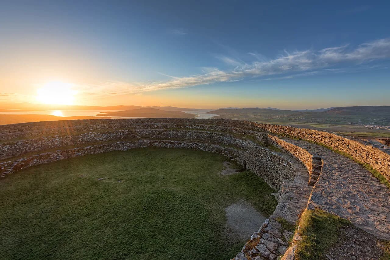
The archaeological definition used by specialist writers describes a ringfort as an enclosed farmstead of the Early Christian or Early Medieval period, generally a circular area bounded by banks and ditches or by a stone wall. Some had timber palisades along the banks, while western examples were often stone-walled with stone huts inside.
Think of the monument as a boundary made of ground rather than masonry. The enclosure separated a household and its animals, stores and workshops from open land, and that is why the surviving trace is usually a ring of raised earth with a dip beside it. Nothing about that form requires a dramatic ruin to be legible.
Reading the Earthworks: Bank, Fosse, Scarp
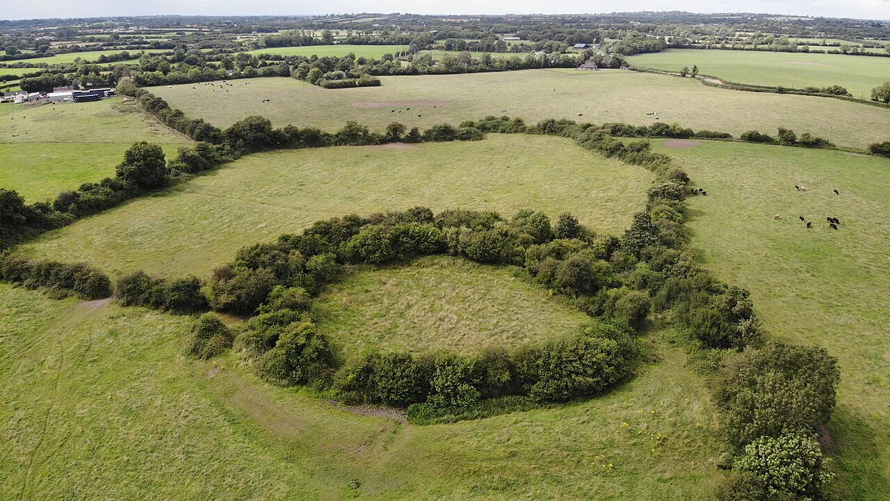
A bank is the raised ridge of earth thrown up to make the enclosure, and a fosse is the ditch beside it. A scarp is the steepened slope created where earth has been cut or built up, and on the ground it reads as a short, abrupt change in level rather than a wall. Carron's own earthwork sequence runs scarp, fosse, bank, then outer fosse and outer bank, which shows how the order of these elements can vary from one monument to the next. Naming the parts helps because a grassy ring viewed from the wrong angle can look like an ordinary field boundary.
The practical test is sequence and shape: does the raised line close on itself, is there a consistent outside ditch, and does the interior sit level while the ground outside falls away? Walk the perimeter before stepping inside, since a single circuit often reveals how many earthworks the builder used.
Why the Numbers Are So Large
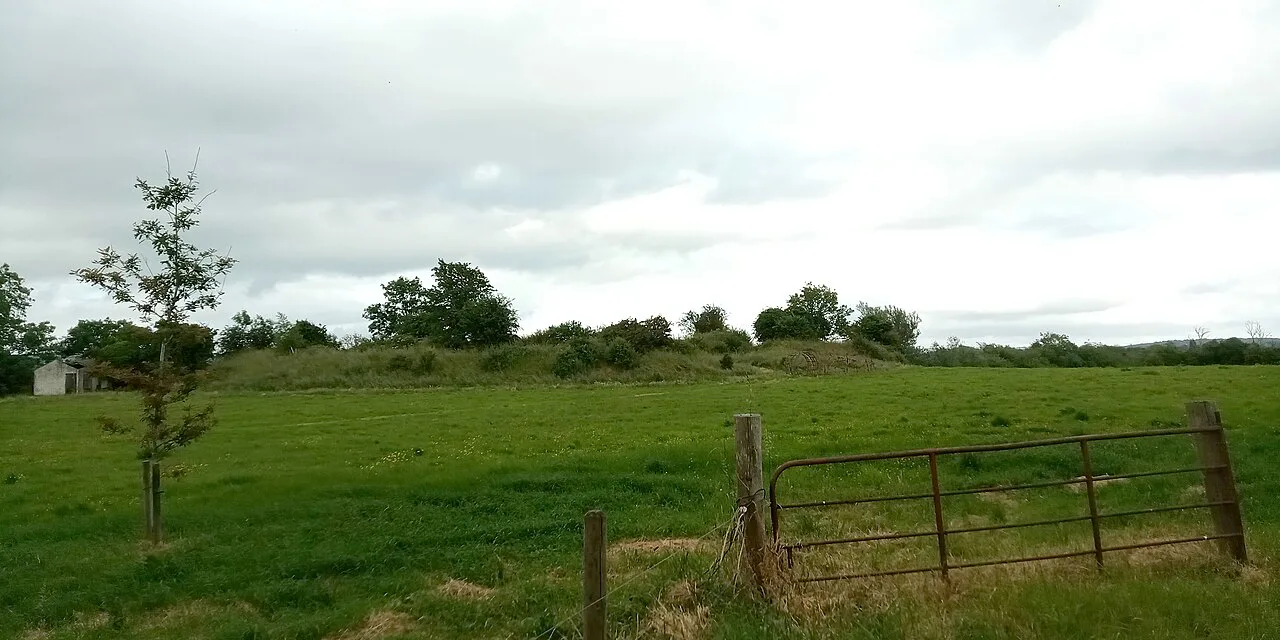
One specialist blog estimates up to 60,000 ringforts survive, placing most between roughly 550 and 900 AD, and describes them as second only to fulachta fiadh among Ireland's common field monuments. Treat those figures as one informed writer's summary rather than an official survey count.
The scale does not imply a single building programme: the majority are understood as farm enclosures of relatively prosperous early medieval households, an interpretation the specialist blog attributes to Dáibhí Ó Cróinín's New History of Ireland. The same source gives typical diameters of about 24 to 60 metres for circular examples, a range that helps you judge whether a faint ring you notice is plausibly a fort; treat both the interpretation and the range as that blog's summary rather than an official survey.
Carron Ringfort: A Rare Trivallate Plan
Carron Ringfort is a state-owned National Monument in the care of the Office of Public Works, located two kilometres east of Limerick Junction in County Tipperary. It is oval, measuring 36 by 32 metres, and its earthworks run through a scarp, fosse, bank, outer fosse and outer bank.
That sequence makes Carron trivallate, meaning it has three banks or fosses, a rarer arrangement than a single-bank enclosure. The official description links such multi-bank plans with people of higher status in society, which is the point of studying Carron: it shows how much variation a single monument type can hold.
The same official page notes that ringforts were built predominantly in the Early Medieval period, though some examples are earlier, from the Bronze Age, and some later, in the Late Iron Age. It also distinguishes small forts usually read as farmsteads from those built as ceremonial sites.
Status and Function in the Enclosure
Archaeologists quoted by the specialist blog agree that the great majority of ringforts were farm enclosures of relatively prosperous households in early medieval Ireland. That framing fits the size of most examples: a family holding with animals, stores and perhaps craft work behind a boundary. If you want to compare this picture of early medieval life with museum collections, the museums in Cork include city and county holdings that help.
Finds of iron and bronze working at some ringforts suggest that certain sites had specialised uses, while others served several purposes at once, according to the specialist blog. The official Carron page links larger multi-bank plans such as Carron's with people of higher status, so status and function are best read as variable from fort to fort.
Many forts also attracted later stories, and in Irish tradition these earthworks often sit alongside fairy lore about raised rings in fields, with solitary bushes and thorns sometimes treated as markers of such ground. The points of contact between that storytelling, the thorn-tree customs around irish fairy trees and the archaeology belong to the wider body of irish folklore rather than to any excavated evidence.
A West Cork Townland Example
A West Cork writer describes a ringfort in the townland of Ballycummisk, seen from inside its enclosure with the north bank visible beyond a stone outcrop said locally to mark a souterrain. The same landscape holds a tall standing stone known as Bishop's Luck, appearing in the earliest 6-inch Ordnance Survey of the 1830s marked 'Gallaun', close enough to invite speculation about a connection.
This is the writer's own observation and local tradition, not a published excavation, and the name lore should be read as legend rather than history. Its value for a visitor is the lesson: a ringfort is best understood in its setting, beside tracks, stones and views that shaped how people used the land. Irish earthwork complexes elsewhere in the country, such as those gathered around Rathcroghan, offer a broader sense of how such monuments can be read together; confirm current access and facilities before travelling.
Access, Permission and Near-Monument Context
Carron is an unguided site in state care, and the official listing carries an explicit warning that unguided monuments require care and caution. It gives no details of staff, paths, parking or facilities, so plan around a simple walk over uneven ground rather than a managed attraction.
Elsewhere, the safer assumption is that a ringfort lies on private farmland: the West Cork writer advises courteous requests for the owner's permission before entering such ground. Check current access details for any monument with the relevant authority before travelling, and respect refusals or unmarked boundaries.
South of Carron stands St Berrihert's Kyle, described by the Office of Public Works as an ecclesiastical enclosure containing a variety of stone monuments. It is a distinct site rather than part of the fort, and the listing supplies no visitor information beyond that description, so treat it as context for the outing rather than a scheduled stop.
Plan Your Ringfort Visit
Start with the vocabulary: bank, fosse, scarp, trivallate. Then pick one monument you can reasonably reach and study its form on the ground, using Carron as the benchmark for a rarer multi-bank plan.
Expect grass, slopes and uneven ground, and treat permission as part of the visit where land is privately held. Carron is an unguided monument in state care carrying a care-and-caution advisory; check the operator's current page for it and for any comparable monument before setting out.
Explore more Ireland guides
Frequently Asked Questions
What is a ringfort in Ireland?
A ringfort is a circular enclosed farmstead of the early medieval period, usually bounded by one or more earthen banks with ditches, or by a stone wall in western areas. Most were working farms of relatively well-off households, and some served craft or ceremonial purposes.
How can you tell a ringfort from an ordinary field bank?
Look for a raised line that closes on itself, a consistent ditch outside it, and a level interior. A bank is the raised ridge, a fosse the ditch beside it, and a scarp the steepened slope between levels. Walking the full circuit is the best way to confirm the shape.
What does trivallate mean at Carron Ringfort?
Trivallate means an enclosure has three banks or fosses. Carron is oval, 36 by 32 metres, and its earthworks include a scarp, fosse, bank, outer fosse and outer bank. The official listing associates such multi-bank plans with people of higher status.
Are ringforts free to visit and can you just walk in?
No general right of entry applies. Carron is an unguided National Monument in state care with a care-and-caution warning, and many other forts stand on private farmland where the owner's permission should be sought first. Check current access details before travelling.
Why are there so many ringforts in Ireland?
One specialist estimate puts surviving examples at up to 60,000, mostly dated between roughly 550 and 900 AD. That volume reflects centuries of ordinary enclosed farming settlement rather than a single building programme, which is why forts appear across so much farmland.
Where is Carron Ringfort and what else is nearby?
Carron lies two kilometres east of Limerick Junction in County Tipperary. South of it stands St Berrihert's Kyle, an ecclesiastical enclosure with a variety of stone monuments; the official listing gives no visitor details for it.
Sources
You might also like
Continue reading
More guides you'll find useful