Corlea Trackway: Ireland's Iron Age Bog Road in Longford
Corlea Trackway in County Longford displays an 18-metre stretch of a 148 BC oak bog road. Learn what to see, how access works, and how to plan a visit.
On this page
The Corlea Trackway is a prehistoric wooden road across a County Longford bog, and an 18-metre section of it is on permanent display at the visitor centre near Kenagh. The surviving oak planks were laid down in 148 BC, according to the operator's account, which also describes the structure as the largest togher, or bog road, of its kind uncovered in Europe. If you are weighing this bogland stop against the midlands' built heritage, our round-up of castles in county offaly covers Charleville, Birr and Leap as a contrasting day out. The site sits on the Longford–Kenagh road, the R357, roughly 3 km from Kenagh village.
Where Corlea sits in the Longford boglands
Corlea lies in open bogland in County Longford, reached by minor roads rather than a main artery, so it rewards travellers who are already touring the midlands. The operator gives the visitor centre as about 3 km from Kenagh village on the R357, and about 15 km from Longford or from the Mullingar–Lanesboro road, the R392. Drivers should treat those figures as approximate approach distances published by the site, not as a live routing service.
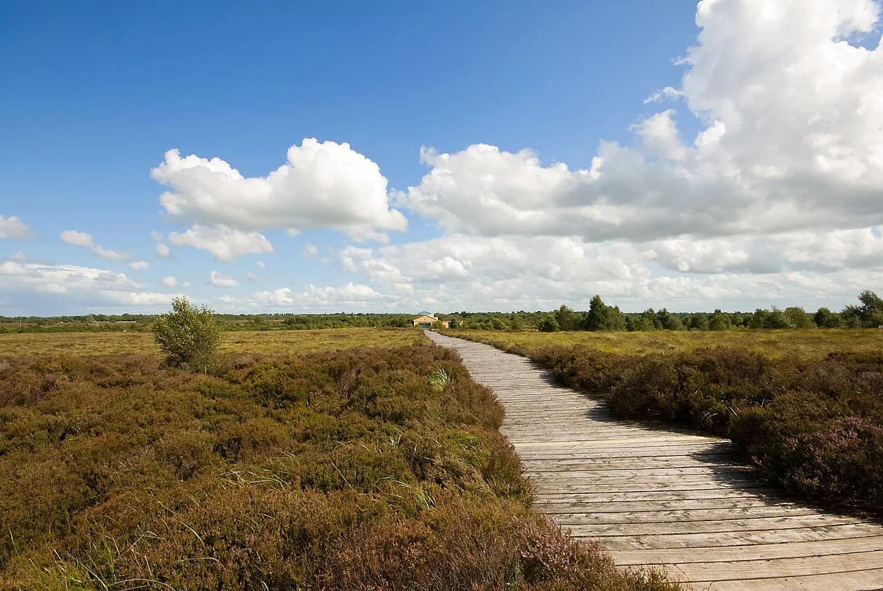
Because the setting is rural farmland and cutover bog, the landscape itself is the context for the archaeology. Anyone building a longer midlands itinerary around ancient sites in Ireland will find Corlea pairs naturally with other prehistoric and early medieval monuments rather than with urban sightseeing. Allow extra time for the final stretch of small road, and check the centre's own directions before setting out.
What the Corlea togher actually is
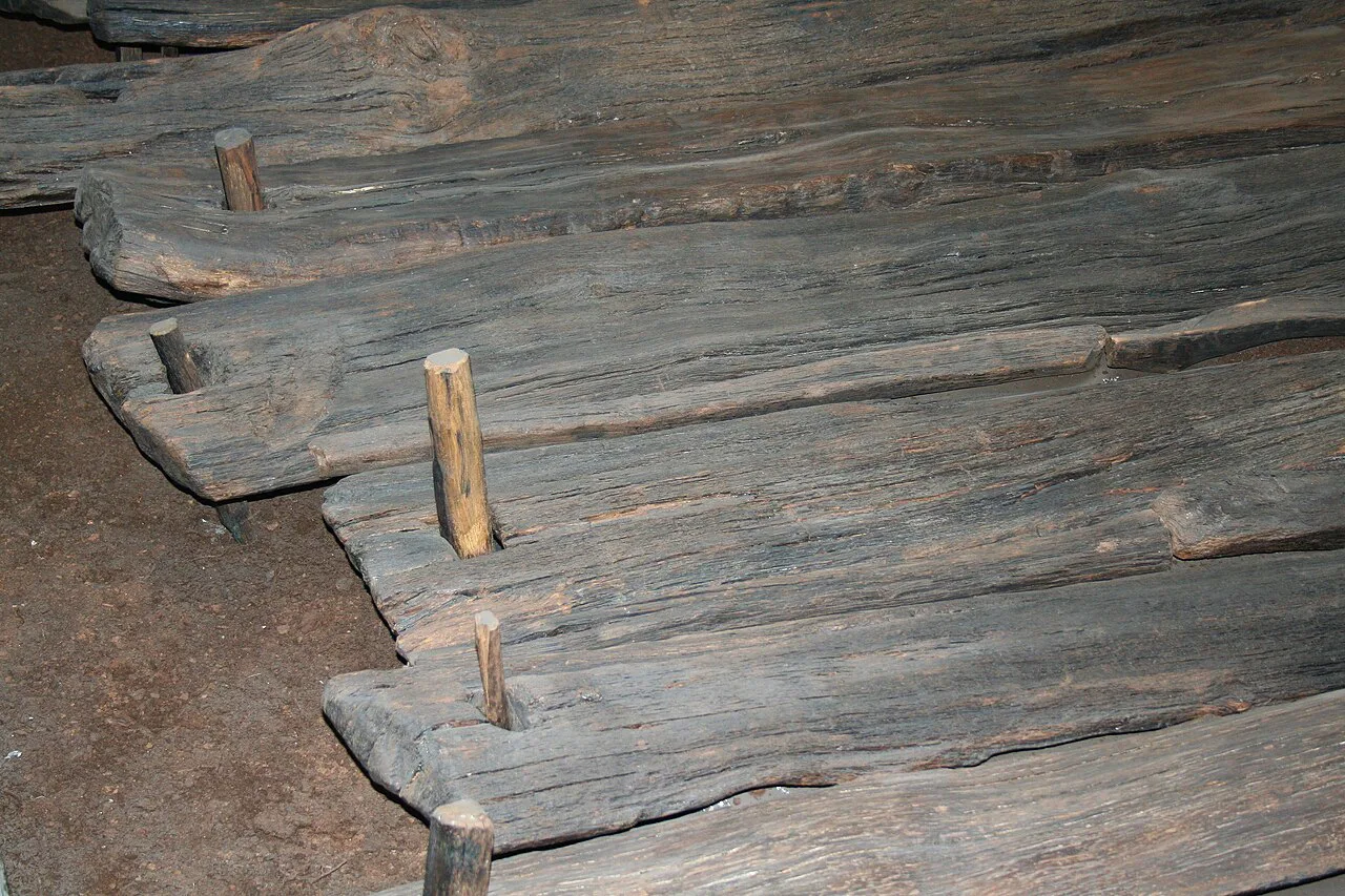
A togher is a wooden causeway laid across wet, unstable ground, and Corlea's was built from heavy oak planks. Locally the structure is known as the Danes' Road, though the name is traditional rather than a record of Viking construction. The operator's page dates the road to 148 BC and calls it the largest of its kind found in Europe; both the date and the superlative are the publisher's claims, repeated in the tourism board's account of the same site.
The road was discovered in 1984 by workers processing peat for a nearby power station, according to Ireland.com, which describes the find as a remnant of prehistory preserved for more than two thousand years. Excavation followed, and objects recovered from the bog — pottery, arrowheads and weapons — are now displayed at the visitor centre with information on where they came from. That combination of structure and finds is what makes a visit more than a look at old timber.
Bog finds such as these sit within a much broader archaeological picture of Iron Age Ireland, and the small assemblage at Corlea is best understood as one site's contribution rather than a survey collection. Treat any comparison between Corlea and other European trackways as a research question rather than something a single source settles.
Why the bog preserved the roadway
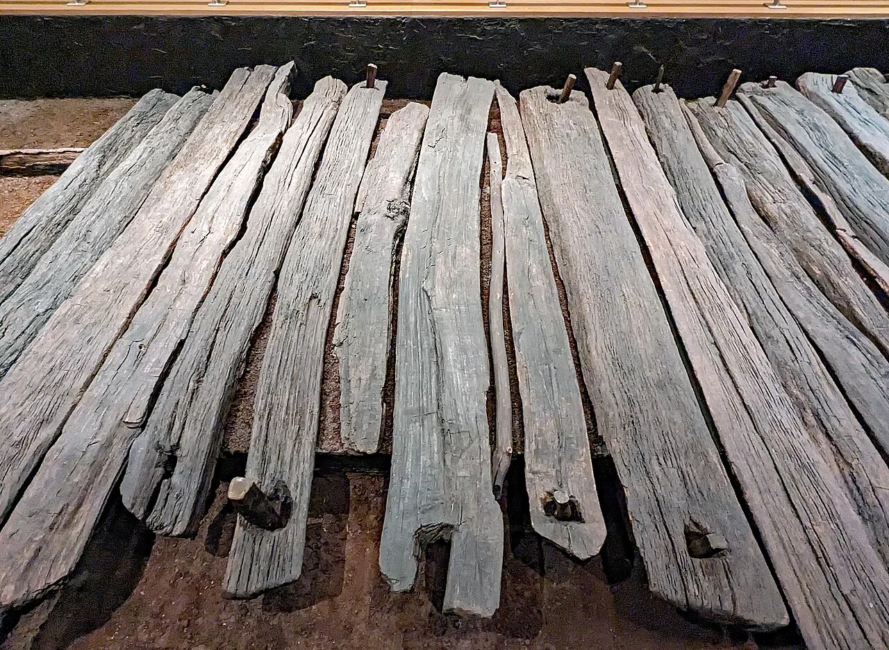
The preservation story is a paradox: the road failed as a road and survived as an artefact. Planks of oak sank into the peat shortly after construction, which made the route unusable but sealed the wood in waterlogged, oxygen-poor ground for two millennia. That is why visitors today can look at original timber rather than a reconstruction.
The surrounding bog has itself been managed to stay wet, according to Discover Ireland, so that the conditions which preserved the wood continue to be represented on site. This matters for how you read the landscape: the dark, soft ground around the centre is not scenery but the mechanism that kept the roadway intact.
The ceremonial-highway interpretation
The operator suggests the Corlea road may have formed part of a route of real importance, possibly a ceremonial highway linking the Hill of Uisneach, described as a ritual centre of Ireland, with the royal site of Rathcroghan in County Roscommon. The operator frames this as a possible reading rather than a certainty, and Ireland.com likewise calls it a believed ceremonial highway. Visitors should treat the royal-route idea as one interpretation among several, not as settled fact.
For travellers following early Irish royal landscapes, the Hill of Tara is another place where kingship and ritual geography are interpreted for visitors, and it makes a complementary stop when you are tracing these themes across the midlands.
Inside the visitor centre
The centrepiece is an 18-metre stretch of the original wooden structure, displayed in a hall the operator says was specially designed to preserve it. Murals depicting people of the past, along with Iron Age tools and objects found in the bog, set the timber in a human context, according to Discover Ireland. The display is indoors, which makes it a sensible stop in changeable midlands weather.
Expect an interpretive exhibition rather than a large national museum, and plan your time accordingly. If your interest is specifically in prehistoric material culture, the centre's artefacts reward close reading; if you are travelling with children, the scale of the surviving planks tends to be the memorable part.
The bog outside the door
Beyond the building, waymarked looped trails cross the conserved bog, and Ireland.com notes that bog cotton, dragonflies and sphagnum moss are part of what you may see. Ireland.com also describes artificial lakes created to maintain the humidity needed to preserve the bog, and outdoor picnic areas at the site. The same source estimates the bog walk at roughly an hour and a half, so it is a genuine outing rather than a five-minute stroll.
Discover Ireland's listing suggests carrying on to the nearby Royal Canal towpath if you still have energy, which makes a useful second leg for a walking-focused day. Wear footwear suited to soft, wet ground and keep to the marked loops, since the bog is actively managed to stay saturated.
Access, hours and admission as published
The operator's page lists opening daily from 10:00 to 18:00, with last admission and the final tour at 17:00. These are the published times, so confirm them with the centre before a long drive. Ireland.com reports that admission to the visitor centre is free and that access to the trackway itself is by guided tour, which is the key distinction for planning: the exhibition and the outdoor structure are not the same experience.
Tour frequency, booking channels, group arrangements and on-site facilities such as a café or shop are not set out in the pages consulted here, so ask the centre directly rather than assuming. Arriving well before the published last-admission time gives you room for both the hall and the bog walk.
Context and nearby heritage
The operator reports a €262,000 award under Fáilte Ireland's Regenerative Tourism and Placemaking Scheme, co-funded by the EU Just Transition Fund and the Government of Ireland, to support a feasibility study on the site's sustainable development and its links to the canals and neighbouring peatlands. That is a planning award, not an announcement of new facilities, so check the centre's own notices for anything that changes your visit.
Corlea fits into a wider midlands circuit: the operator lists Rathcroghan Visitor Centre and Clonmacnoise Monastic Site among nearby sites, and both extend the theme of early Irish ritual and monastic landscapes. If your trip is taking in more historic sites across the region, our round-up of castles in county offaly covers Charleville, Birr and Leap as another midlands stop. For a similar shortlist of fortified sites to the west, our guide to castles in county galway covers four sites and their current access. For more prehistoric and early medieval monuments to pair with a midlands tour, see our guide to ancient sites in Ireland.
Plan Your Visit
Corlea rewards a deliberate detour: the displayed timber, the small finds and the bog itself together tell a story of a road that failed and was therefore saved. Build the visit around the published hours, remember that the trackway is reached by guided tour while the centre's admission is reported as free, and leave time for the roughly 90-minute bog walk.
Explore more Ireland guides
Frequently Asked Questions
What is the Corlea Trackway and how old is it?
It is a wooden togher, or road, built across bogland in County Longford. The operator and Ireland.com both date its construction to 148 BC and describe it as made from heavy oak planks. A section of the original structure is displayed at the visitor centre near Kenagh.
Why is the Corlea roadway so well preserved?
The oak planks sank into the peat shortly after the road was built, which made it unusable but sealed the wood in waterlogged ground. The bog's wet, low-oxygen conditions preserved the timber for roughly two millennia, and the surrounding bog is managed to stay wet.
Is the Corlea Trackway the same as the Danes' Road?
Yes, the Danes' Road is the local name for the structure, according to the operator. The name is traditional and does not mean the road was built by Vikings; the published dating places it in the Iron Age, in 148 BC.
Do you need a guided tour to see the trackway at Corlea?
Ireland.com reports that admission to the visitor centre is free while access to the trackway itself is by guided tour. Ask the centre about tour times and any booking requirements when you plan, since published pages do not set these out.
How long does the bog walk at Corlea take?
Ireland.com estimates the bog walk at about an hour and a half over looped trails, with facilities including outdoor picnic areas. Footwear for wet, soft ground is sensible, and you should allow time for the indoor exhibition as well.
Where is Corlea Trackway Visitor Centre in County Longford?
The operator places it about 3 km from Kenagh village on the Longford–Kenagh road, the R357, and about 15 km from Longford or from the Mullingar–Lanesboro road, the R392. These are published approach distances; confirm directions with the centre before travelling.
Is the Uisneach–Rathcroghan ceremonial route proven?
No. The operator and Ireland.com describe the link between the Hill of Uisneach and Rathcroghan as a possible ceremonial highway, framed as an interpretation rather than an established fact. Treat it as one reading of the road's purpose.
What should I pair with a visit to Corlea?
The operator lists Rathcroghan Visitor Centre and Clonmacnoise Monastic Site among nearby heritage sites, and Discover Ireland suggests the Royal Canal towpath for an extra walk. These pairings suit travellers already touring the midlands by car.
Sources
You might also like
Continue reading
More guides you'll find useful