Céide Fields: Neolithic Site and Visitor Centre Guide
Plan a visit to the Céide Fields in north Mayo, from the Neolithic walls beneath blanket bog to the cliff-edge visitor centre and what to prepare for.
On this page
The Céide Fields are a Neolithic farming landscape in north Mayo, preserved beneath blanket bog as a spread of stone-walled fields, dwelling areas and megalithic tombs. Heritage Ireland, which manages the site and visitor centre, describes it as the most extensive Stone Age monument in the world and the field walls as the oldest known globally, extending over hundreds of hectares.
That framing is worth holding alongside what visitors actually encounter: a bog-covered hillside, a modern interpretive building and a cliff-edge setting rather than a set of upstanding ruins. The guide below separates the buried archaeology from the visitor experience, explains how dating work has shaped the story, and sets out the practical details the operator publishes.
What the Céide Fields Are
The monument consists of stone-walled fields laid out across a landscape that blanket bog later swallowed, together with dwelling areas and megalithic tombs. Because the bog sealed the ground, the walls and field boundaries survived rather than being ploughed or rebuilt over later centuries. The result is a readable prehistoric farming layout rather than a single monument.
Visitors should not expect to walk through a grid of exposed walls at ground level. The field system is largely beneath peat, and the visitor centre exists to interpret what lies under the surface and to explain the bog ecology that preserved it. Understanding this before arriving prevents the common disappointment of looking for something more conventionally monumental.
Why the Walls Survived
Blanket bog growth is the reason the Neolithic layout is still there to study. As peat accumulated across the farmed ground, it protected the walls from later disturbance and left researchers a rare snapshot of how fields were divided. Heritage Ireland notes that the bog carries its own vegetation and wildlife, so the same cover that preserved the archaeology now forms a living habitat around it.
Bog growth was not a tidy event that ended farming overnight. Research reported on the site's later phases places major bog expansion in the late Neolithic, before the Bronze Age, after the most intensive farming had already eased. That sequence matters for how visitors read the landscape: the peat is both the preserver and a sign of the environmental change that followed occupation.
How the Site Came to Light
The popular account of the discovery begins with turf cutting, when local schoolmaster Patrick Caulfield encountered quantities of stone deep in the bog and recognised that their arrangement was unlikely to be accidental. His son, the archaeologist Seamus Caulfield, later investigated the site using iron probes of the kind employed to find ancient trees beneath peat. This narrative is attributed to the IrishCentral account and is best treated as the story of how the site entered public awareness.
The same account gives the Irish name Achaidh Chéide as meaning flat-topped hill fields, which fits the setting above the north Mayo coast. Whatever the exact sequence of discovery, the point for visitors is that this is a landscape read through peat depth, stone alignments and probing rather than a monument excavated from open ground.
How Researchers Date and Interpret the Fields
Dating the walls relies on several lines of evidence rather than a single test: archaeological survey and excavation, pollen analysis, study of bog-pine timbers and radiocarbon dating. Research from the Palaeoenvironmental Research Unit at NUI Galway, associated with Michael O'Connell, Karen Molloy and Eneda Jennings, concluded that the field system belongs to the early Neolithic, roughly 6,000 years ago.
The farming reconstructed from fossil pollen was mainly pastoral, most likely cattle-based, with cereal cultivation also present. The researchers describe an intensive opening phase beginning around 3800 BC and lasting roughly 400 years, followed by three centuries of reduced but still substantial farming. Visitors reading the landscape should picture livestock and mixed cultivation in a cleared woodland setting, not a bare stone landscape.
Why Farming Ended: A Debate, Not a Verdict
Climate change is the obvious explanation for the retreat of farming, but the NUI Galway research treats it as insufficient on its own. Deforestation, soil acidification and the exhaustion of nutrients through prolonged use are among the factors raised, alongside a possible population decline driven by cultural and socio-economic change. Visitors should treat the end of Neolithic farming here as an open question rather than a settled story.
The later record also includes pine growing within the bog, documented through fossil timbers preserved in peat in Mayo and elsewhere. That detail helps place the Céide Fields within a wider story of changing woodland and wetter conditions in western Ireland, which makes the site a useful comparison point when reading other prehistoric landscapes. For broader context on the period, the ancient sites ireland collection covers comparable monuments across the island.
The Visitor Centre and the Cliff Setting
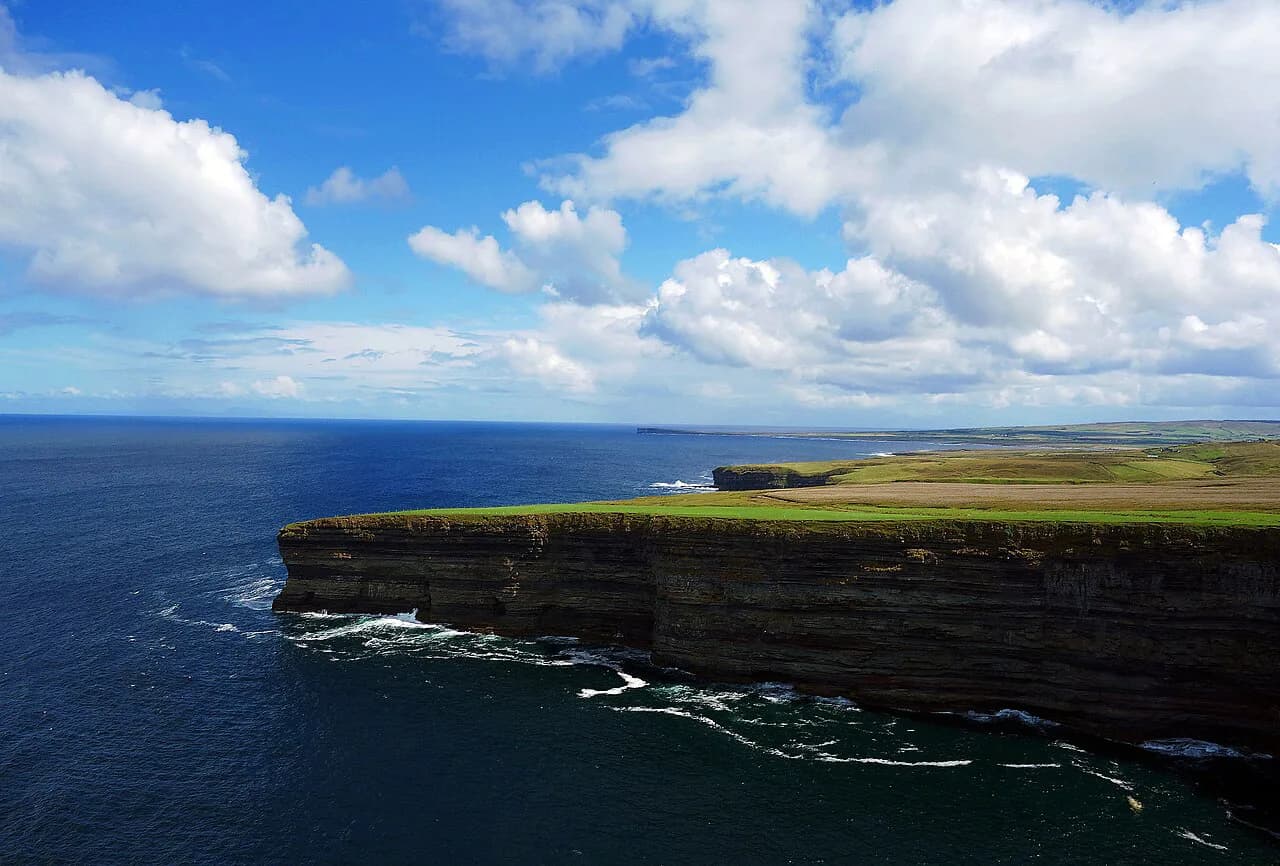
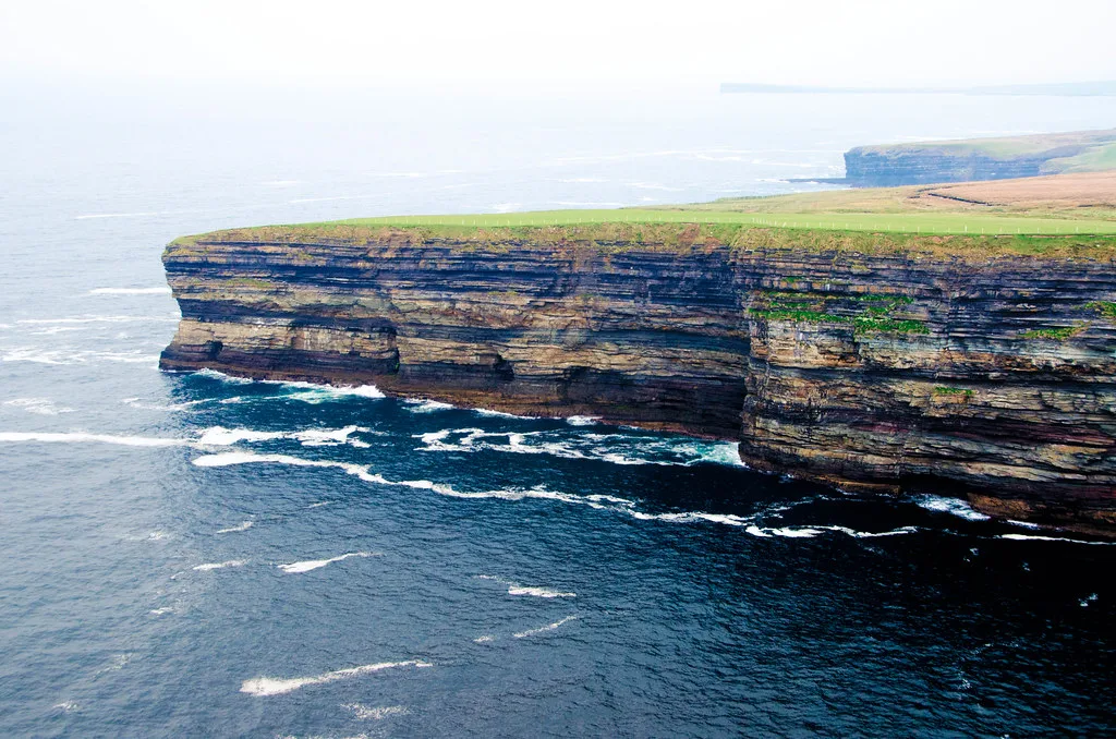
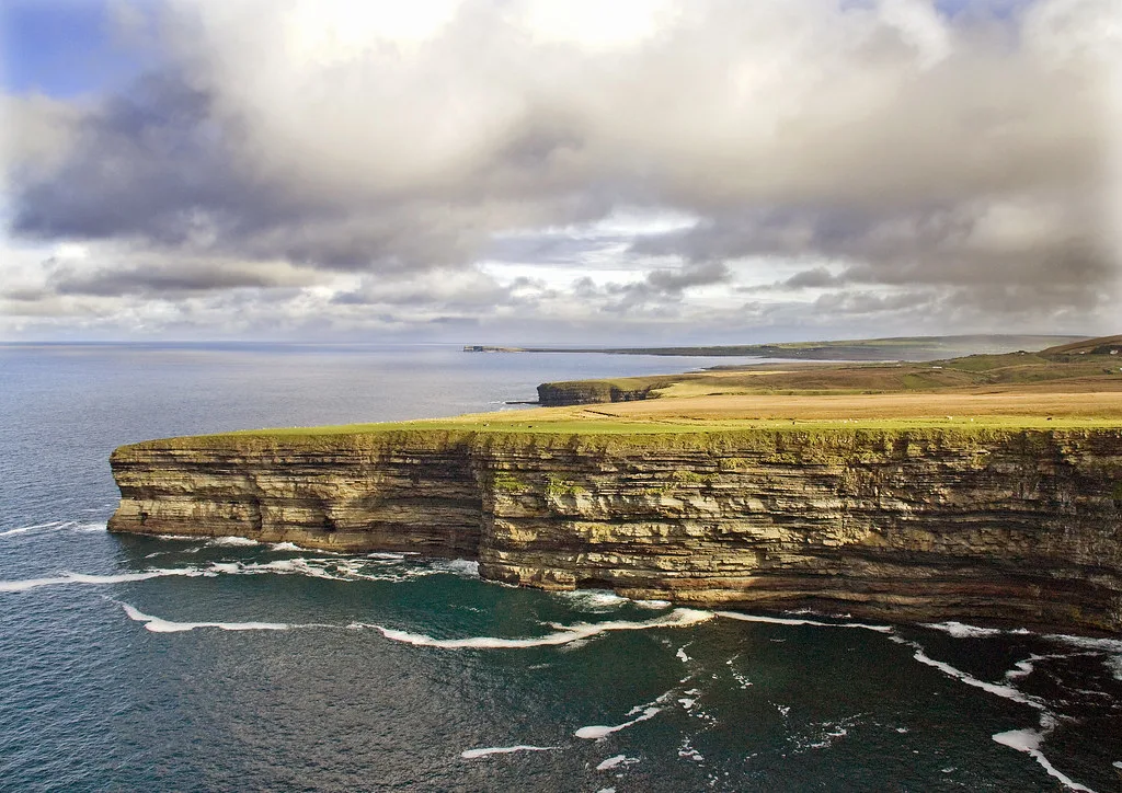
The visitor centre is the interpretive starting point, explaining the buried field system and the formation and ecology of the blanket bog. Heritage Ireland describes it as award-winning and notes that the surrounding rock formations are among the most dramatic in Ireland. A viewing platform on the edge of a 110-metre cliff gives the coastal dimension of the visit, though no paths, lifts or step-free routes are stated, so visitors should not assume easy access to every viewpoint.
The outdoor setting is part of the experience, and the official cautions are specific. The terrain and the weather can be challenging, and the page advises protective clothing and sturdy footwear. That advice is not boilerplate on an exposed Atlantic coast, and treating the visit as a proper walk rather than a quick stop will make it more comfortable.
Practical Planning for the Visit
The operator lists opening daily from 10:00 to 18:00 with last admission at 17:15, and notes that from 5 November the winter months are available for bookings. That note is not a statement of closure, and no reopening date should be assumed. Because hours can vary with the season and bookings, confirm current arrangements on the official page before travelling.
A downloadable visual guide is published for first-time visitors, families and people with developmental and learning disabilities, and downloading it in advance helps prepare anyone who finds unfamiliar settings difficult. The page does not state admission prices, so check the same official source rather than relying on third-party listings. Allow enough time for both the centre and the outdoor ground.
Nearby Heritage Sites
Heritage Ireland lists three nearby sites with approximate distances: Carrowmore Megalithic Cemetery in County Sligo at about 61.2 km, Sligo Abbey at about 64.2 km, and Parke's Castle at about 73.1 km. These figures indicate regional proximity rather than a ready-made route. Travelers touring the northwest can use them to judge whether a detour fits the day.
Carrowmore is a megalithic cemetery, a different class of monument from a buried field system, so pairing the two offers contrast rather than repetition. Further inland, the hill of tara ireland site adds another layer of Irish prehistoric and early historic landscape to compare against the Mayo coast. If you are weighing a city stop against these rural sites, the Museums in Galway City: Two Places Worth Your Time guide shows what an indoor heritage option adds to the mix. Neither comparison substitutes for the Céide Fields' own story of farming preserved by peat.
What the Site Can and Cannot Tell You
The Céide Fields offer an interpreted landscape, not a reconstructed village. What survives is a pattern of walls, boundaries and tombs read through survey and environmental science, and the visitor centre translates those findings for a general audience. Asking what the evidence supports, rather than looking for certainty, is the most rewarding way to approach the displays.
Superlatives such as the most extensive Stone Age monument in the world are the operator's framing of the site's importance, not a claim independently verified by every researcher. That makes them a starting point for understanding scale and significance rather than a conclusion. Visitors interested in how the site relates to Ireland's wider prehistoric record can use the comparison as a prompt to read further.
Plan Your Visit
The Céide Fields reward visitors who come prepared to read a bog-covered landscape rather than tour a set of standing ruins. Arrive knowing that the walls lie beneath peat, that the cliff-edge centre and viewing platform supply the setting and interpretation, and that weather and terrain demand proper clothing and footwear.
Confirm the current opening arrangements and the winter bookings note on the official page before setting out, and download the visual guide if it will help your group prepare. With the archaeology put in context, the site becomes a lesson in how farming, climate and peat have shaped one corner of north Mayo. For related heritage guides, read about Dun Aonghasa and Knocknarea Cairn.
Explore more Ireland guides
Frequently Asked Questions
What are the Céide Fields?
They are a Neolithic farming landscape in north Mayo, consisting of stone-walled fields, dwelling areas and megalithic tombs preserved beneath blanket bog. Heritage Ireland describes the field system as the most extensive Stone Age monument in the world, with walls it calls the oldest known globally, extending over hundreds of hectares.
How old are the Céide Fields?
Research associated with NUI Galway's Palaeoenvironmental Research Unit dates the field system to the early Neolithic, almost 6,000 years ago, with an intensive farming phase beginning around 3800 BC and lasting roughly 400 years. The dating draws on survey, excavation, pollen analysis, bog-pine timbers and radiocarbon evidence.
Why are the fields buried under bog?
Blanket bog grew across the farmed landscape after the main Neolithic occupation, sealing the stone walls and preserving them from later ploughing and rebuilding. The same peat now forms a living habitat, which is why the visitor centre also explains bog formation and ecology.
What can I see at the visitor centre?
The centre interprets the buried field system and the ecology of the blanket bog, and the surrounding cliff setting includes a viewing platform on a 110-metre cliff edge. The site publishes a visual guide for first-time visitors, families and people with developmental and learning disabilities.
What should I wear when visiting?
Treat it as an exposed outdoor visit. The official guidance notes that the terrain and weather can be challenging and advises protective clothing and sturdy footwear, which matters on a coastal site where conditions change quickly.
Are the Céide Fields open in winter?
The published information lists daily opening from 10:00 to 18:00 with last admission at 17:15, and notes that from 5 November winter months are available for bookings. That is not a statement of closure, so confirm current arrangements on the official page before travelling.
How long should I allow?
Allow time for both the interpretive displays and the outdoor ground, since the centre explains what lies beneath the bog and the cliff-edge setting is part of the experience. Build in extra time for weather and for reading the landscape rather than rushing between the two.
How old is the discovery story?
The popular account traces the site's discovery to turf cutting and to local schoolmaster Patrick Caulfield, with later investigation by his son, the archaeologist Seamus Caulfield. That narrative is attributed to the IrishCentral account rather than presented as an official excavation history.
Sources
You might also like
Continue reading
More guides you'll find useful