Knocknarea Cairn: Queen Maeve's Cairn and the Summit Walk
Knocknarea Cairn is a huge unopened summit monument above Strandhill, County Sligo. Learn the Maeve legend, the archaeology and the 6 km loop walk.
On this page
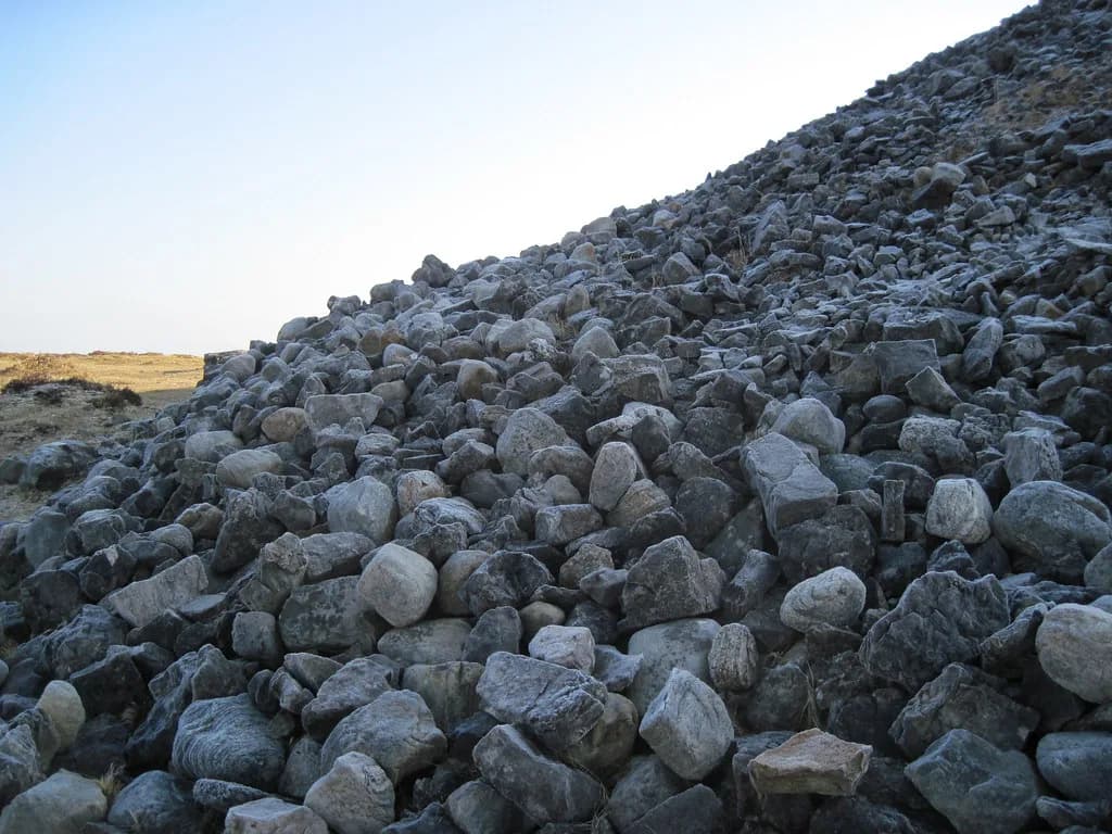
The Knocknarea cairn is a huge stone mound on the summit of Knocknarea, a limestone hill on the Coolera Peninsula above Strandhill in County Sligo. It is known as Queen Maeve's Cairn, or Miosgán Meadhbha, and it sits on a protected National Monument that visitors may walk up to but must not climb on or alter.
The visit combines a strenuous hill walk with a monument whose meaning is still debated. Legend gives the mound to a warrior queen of Connacht, while archaeologists read it as a much older passage tomb that has never been excavated. Sorting those two stories apart is the most useful thing a visitor can do before setting out.
Where Knocknarea Stands
Knocknarea rises to a 327-metre summit on the Coolera Peninsula, close to the coastal town of Strandhill. The national tourism board describes it as a hill overlooking that town, with wide views on a clear day toward the Ox Mountains, Lough Gill, Slieve League in Donegal and Croagh Patrick in Mayo.
The hill is nicknamed the Hill of Kings, a name tied to a tradition that the ancient kings of Connacht were crowned there. Treat that as tradition rather than record: it explains the hill's cultural weight, not a documented ceremony you can date. The regional tourism site describes Knocknarea as a prominent limestone mountain whose steep flanks make it a popular walking destination.
The Cairn Itself: Scale and the Word 'Unopened'
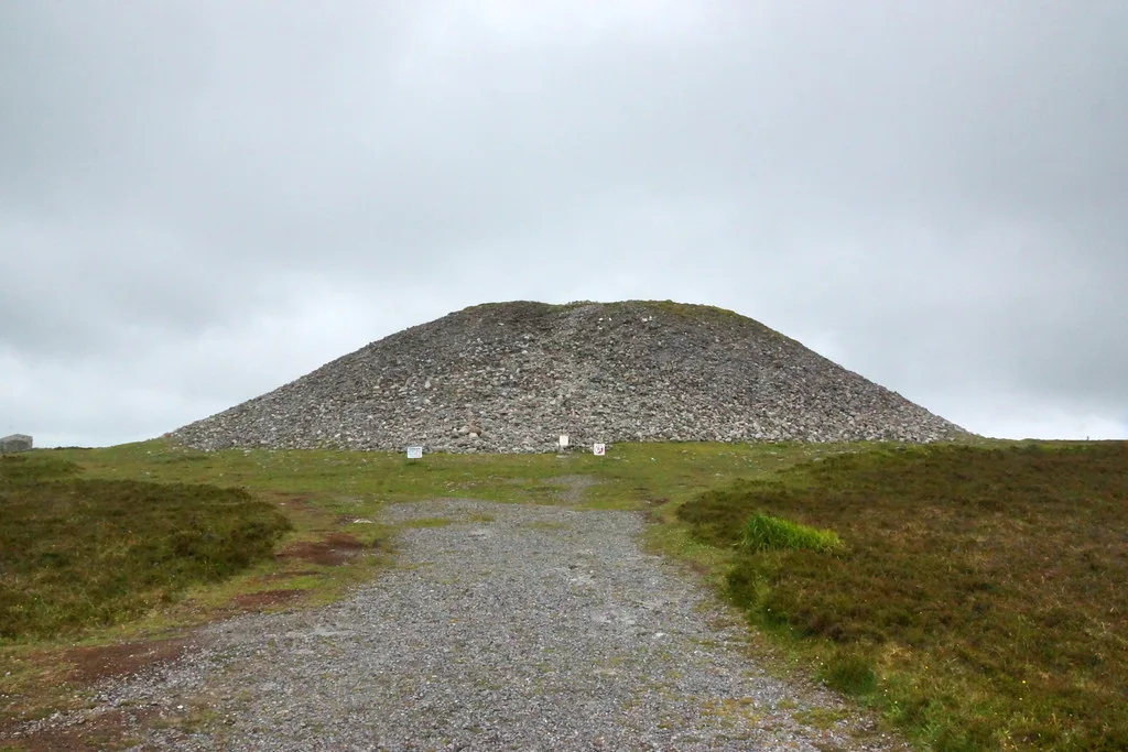
The summit mound measures about 55 metres across and roughly 10 metres high, according to the regional tourism site, which adds that smaller tombs are scattered around the summit and may be older still. The national tourism board puts the stone at more than 40,000 tonnes and calls it the largest unopened cairn in Ireland, an estimate worth reading as a description rather than a survey figure.
"Unopened" is the key word. The cairn has never been excavated, which is why its internal structure remains an open question rather than a known plan. That single fact changes how you should read every confident description of a chamber inside it, including the ones that circulate online.
If cairn architecture is what draws you, it helps to see how Irish examples compare. A wider look at cairns in Ireland shows how summit mounds differ from dolmens and court tombs, which makes the unexcavated Knocknarea mound easier to place in context.
Legend Over Monument: Miosgán Meadhbha
The Irish name Miosgán Meadhbha ties the mound to Medb, or Maeve, the queen of Connacht in the Ulster Cycle. According to the legend, she is buried upright and in armour inside the cairn, facing Ulster so that she guards her province against her enemies even in death.
The national tourism board repeats the standing-burial story in its own words, saying Maeve is said to be buried standing up so she can watch over the province she ruled. The Ulster Cycle itself is set around the turn of the eras, roughly 100 BCE to 100 CE, in a period that leaves little archaeological trace — a chronology drawn from the archaeology commentary below.
That chronology is the crux. If a historical Maeve lived in the first century CE, she would postdate the mound by thousands of years, and archaeologists do not treat the cairn as her grave. The legend deserves to be told as legend, which is also how it has protected the site: stories keep a monument in mind.
The pattern of a famous figure attached to a far older monument recurs across Ireland, and the Hill of Tara is a useful contrast: there the early medieval and legendary associations cluster around earthworks rather than a single great cairn. Reading the two together makes clear how differently Irish sites carry their stories. For a different pairing, the castles in county galway show the same instinct at work in stone, where far later builders attached their own stories to older landscapes.
Archaeology and Dating: A Passage Tomb, Probably
The reading most often cited is that the cairn is a passage tomb built somewhere between about 3400 and 3200 BCE, based on its size and its sightlines to other megalithic sites. The same commentary notes that the mound is roughly 70 percent the size of Newgrange, which gives a sense of its scale among Irish passage tombs.
The regional tourism site offers a similar but looser date, saying the cairn was probably built around 3400 BC. These are interpretations, not results from digging, so the honest position for a visitor is that the date is well argued but unconfirmed by excavation.
For anyone following the wider story of Irish megaliths, this is squarely a neolithic monument, and knowing that vocabulary helps when reading site notices and museum panels. It also explains why the mound is compared with Newgrange rather than with later ringforts or castles; if castle comparisons are what interest you more, the castles in county galway show how a much later wave of builders reused and reframed older landscapes, and the castles in county offaly offer a similar contrast for the midlands.
The Unresolved Chamber Question
Because nobody has cut into the cairn, the existence and position of an internal chamber remain hypotheses. A recent feasibility study tested whether muon tomography, which images the inside of large dense objects, could detect a chamber at Knocknarea without excavation; the researchers ran simulations with and without an idealised chamber and found the method workable in principle.
That is a long way from a discovery. No chamber has been found at Knocknarea and no passage has been detected, and the study's own author describes the modelled conditions as only semi-ideal. Visitors should be sceptical of any claim that the cairn has been opened or scanned conclusively.
The Wider Ritual Landscape: Carrowmore and Carrowkeel
Knocknarea is best understood as one point in a larger Neolithic cemetery landscape. The same commentary, quoting published researchers, describes the hill as the western anchor of an axis with Carrowmore about four kilometres east and Carrowkeel about 23 kilometres southeast, and notes that these sites have been nominated for UNESCO status under the title of the Passage-Tomb Landscape of County Sligo.
Nomination is not inscription. The landscape is not a World Heritage Site on the strength of that proposal, and visitors should describe it as a nominated candidate rather than a listed one. The national tourism board separately points readers to Carrowmore Megalithic Cemetery and its visitor centre for more on the tombs, but that is a distinct site with its own arrangements, not a facility serving Knocknarea.
Travellers building a megalithic circuit in the northwest can add other court tombs and dolmens to the same trip. Creevykeel Court Tomb is another County Sligo monument and gives a ground-level contrast to the summit cairn.
Approaching on Foot: Two Starting Points
There are two supported places to begin: the Strandhill side of the hill, or Glen Road at the Knocknarea car park. Whichever you choose, the route is described as a looped walk of about six kilometres, and the national tourism board grades the Queen Maeve Trail as strenuous, over gravel paths and a wooden bog bridge.
The choice between the two is one of convenience rather than scenery, since both feed the same summit. The regional tourism site names Glen Road as the Knocknarea car park, while the Strandhill approach starts from the coastal town itself. The sources give no walk times or facilities on the hill, so plan on the stated distance and grading rather than assuming benches, toilets or shelter.
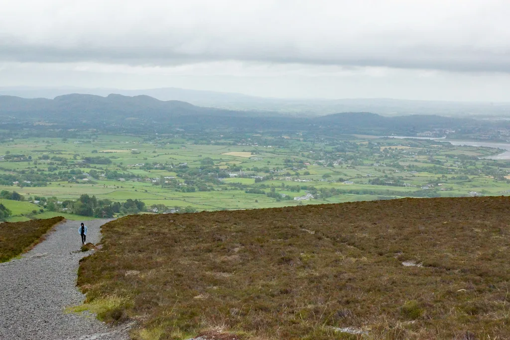
The climb rewards the effort with a broad view over Sligo and beyond, which is a large part of why the hill is visited at all. Treat the summit as a place to linger briefly and look outward, not as a platform to be conquered.
Visiting With Care: the No-Climbing Rule
The summit cairns are protected National Monuments, and climbing onto them is strictly forbidden. Signs around the site discourage people from scaling the stones, and the commentary on the site records that footfall, stone removal and stone addition are the main threats to the monument's fabric.
In practice this means walking the loop, approaching the mound to look, and keeping your hands off the stones. Do not add a stone for luck and do not pocket one as a keepsake; both acts change an archaeological monument that no one has excavated. Read the signs before you step off the path near the summit.
The same courtesy applies at every open monument in the country, from burial mounds to stone circles, where access depends on visitors treating fragile ground with restraint. Our guide to ancient sites ireland sets out how protection works at these places and why the rules vary.
Cultural Afterlife: Yeats and the Hill Today
Knocknarea and Queen Maeve feature in several poems by W.B. Yeats, whose writing gave the Sligo landscape a lasting place in Irish cultural memory. The cairn also has a modern life as a race route: the regional tourism site describes the Warriors Run, in which around a thousand runners leave Strandhill village, climb to the cairn and descend back over a course of roughly 16 kilometres.
That race belongs to the hill's present rather than its prehistory, and its timing and entry arrangements should be checked with the organisers rather than assumed from any older account. On an ordinary day the summit is a quieter place, where the myth and the archaeology simply sit side by side.
Practical Decisions: Weather and Navigation
The hillside is exposed, and the regional tourism site warns that conditions can shift quickly once you leave the shelter of forest, with visibility deteriorating as mist or wind arrives. Carry clothing for wind and rain, water, a map or navigation app and a charged phone, and be ready to turn back if the cloud closes in.
If the weather turns, skip the summit rather than pressing on. The cairn will still be there on another day, and the walk is only worth completing when you can see where you are going and enjoy the view that makes the climb worthwhile.
Anyone planning to link Knocknarea with other sites should plot them on a map before travelling, since the wider tombs are spread out rather than clustered at the one hill. An ancient ireland map makes those distances obvious and helps you decide how much to attempt in a single day.
Plan Your Visit to Knocknarea Cairn
Knocknarea rewards a visitor who arrives knowing two things: the mound on the summit has never been excavated, and the queen said to lie inside it belongs to legend rather than to the archaeology. Walk the loop from Strandhill or Glen Road, look at the cairn without climbing it, and leave the stones exactly where they are.
Before you set out, confirm current conditions and the state of the paths with the sources that maintain visitor information, since this exposed hill is not a place to rely on an old account. Then give the summit the time it deserves, and let the view over Sligo explain why people have been climbing this hill for thousands of years.
Explore more Ireland guides
Frequently Asked Questions
Can you climb the cairn at Knocknarea?
No. The summit cairns are protected National Monuments and climbing on them is strictly forbidden. Signs at the site discourage scaling the stones, and footfall, along with adding or removing stones, damages the monument. Walk the loop and view the mound from the path.
Is Queen Maeve actually buried in the cairn?
That is legend, not an archaeological finding. The story says Maeve is buried upright in the mound, but archaeologists date the cairn to roughly the fourth millennium BCE, thousands of years before the period in which the Ulster Cycle is set. The cairn has never been excavated.
How long is the walk to Queen Maeve's Cairn?
The route is described as a looped walk of about six kilometres, graded strenuous, over gravel paths and a wooden bog bridge. The sources give no walking times, so allow for the distance and the climb rather than a published schedule.
Where do you start the Knocknarea walk?
Two starting points are supported: the Strandhill side of the hill, or Glen Road at the Knocknarea car park. Both connect with the same summit route, and neither is described as having facilities on the hill.
Has the cairn ever been excavated?
No excavation has taken place, which is why its internal structure is unknown. A feasibility study has examined whether muon tomography could detect a chamber without digging, but no chamber or passage has been found.
What is the cairn at the top of Knocknarea?
It is a large stone mound about 55 metres across and 10 metres high, known as Queen Maeve's Cairn or Miosgán Meadhbha. Archaeologists interpret it as a Neolithic passage tomb, probably built around 3400 BCE, though that reading remains unconfirmed by excavation.
Sources
You might also like
Continue reading
More guides you'll find useful